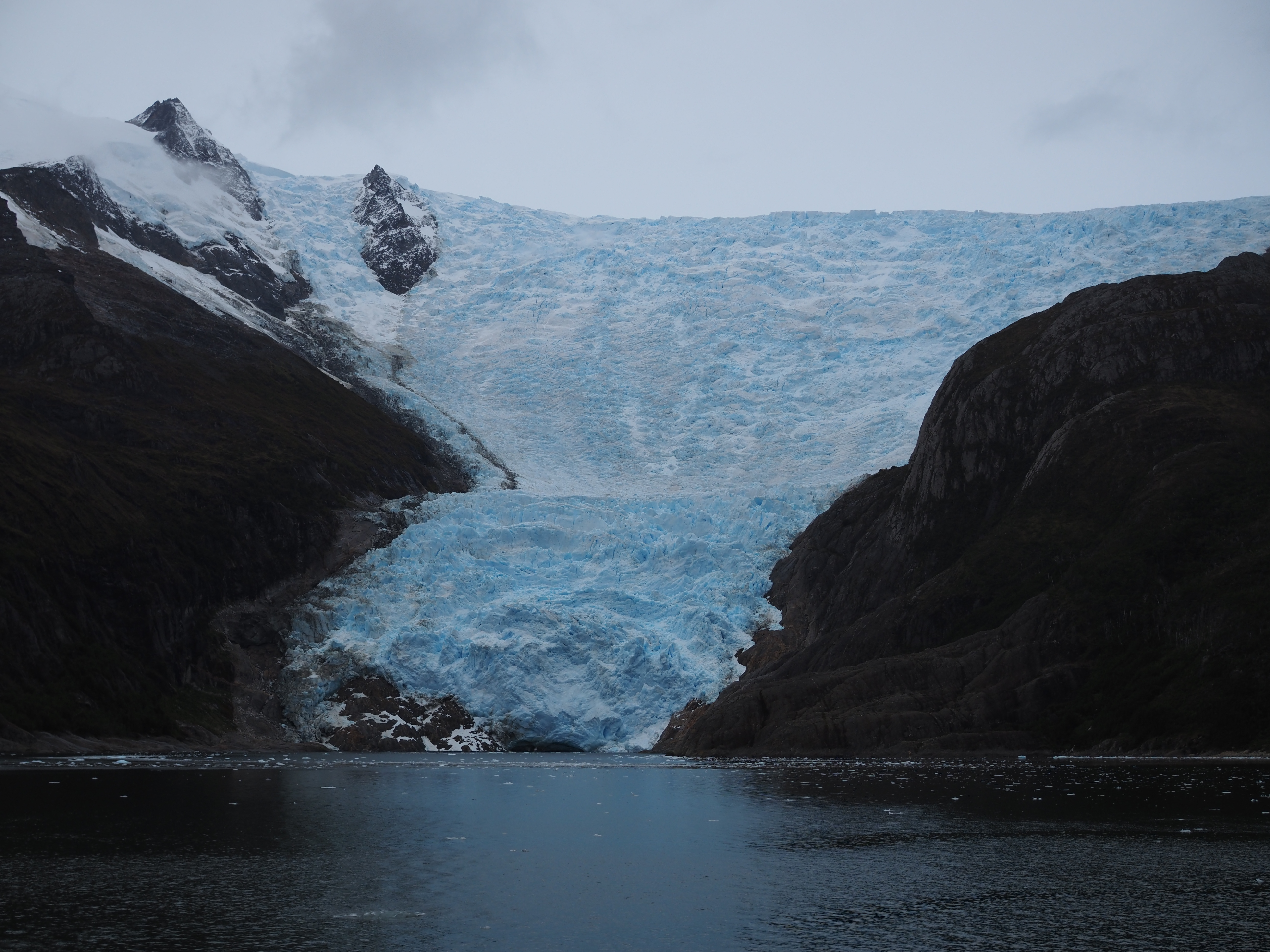
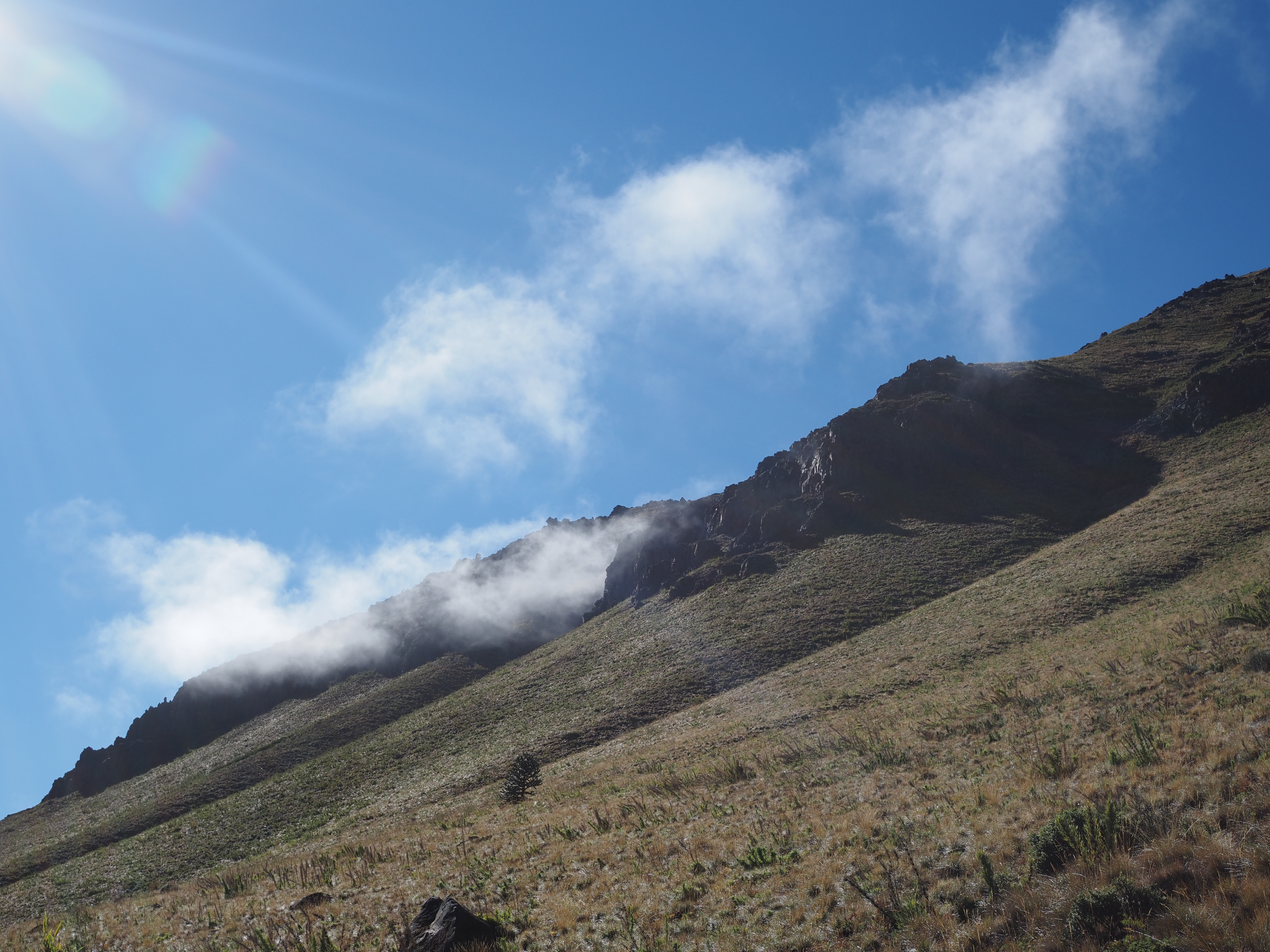
Los Dientes de Navarino promotes itself as “the world’s southernmost hiking trail”. Located on the Navarino isle at the southernmost tip of the American continent, this might hold true (unlike half a dozen restaurants in Patagonia calling themselves “Fin del Mundo” ;). The GPT includes it as section 67 and – unsurprisingly – extends it even further south towards Lago Windhond. Between the ferry and flight schedules, we had only two hiking days, so we stuck to the original Dientes de Navarino loop. Remote and magic views once again, without the cattle or arrieros we’ve gotten used to. The autumn colors of the shrubs contrasted beautifully with the green grass and the grey mist on the second day. And the rivers transported water from high lake to low, like a slippery staircase for giants.
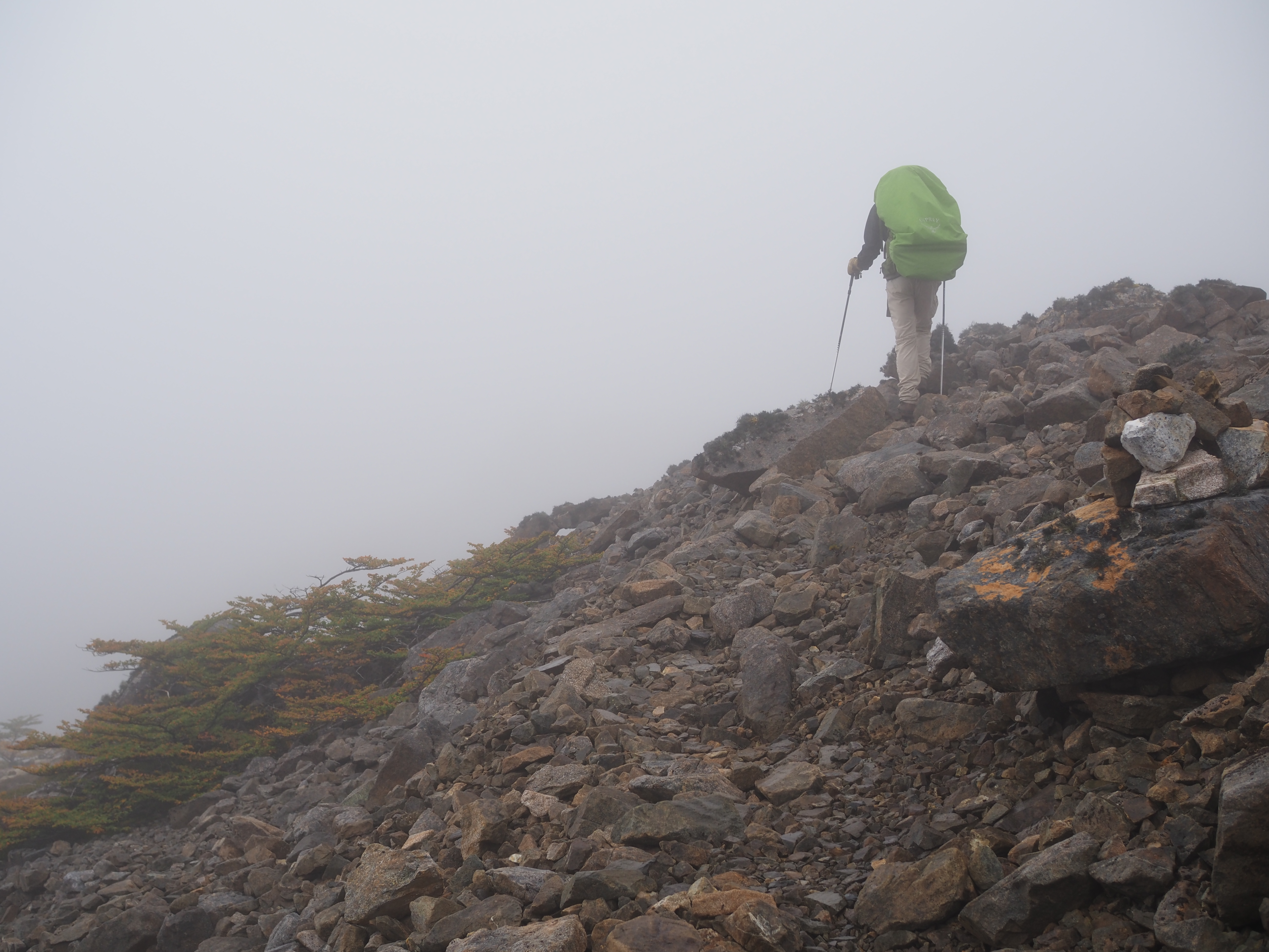
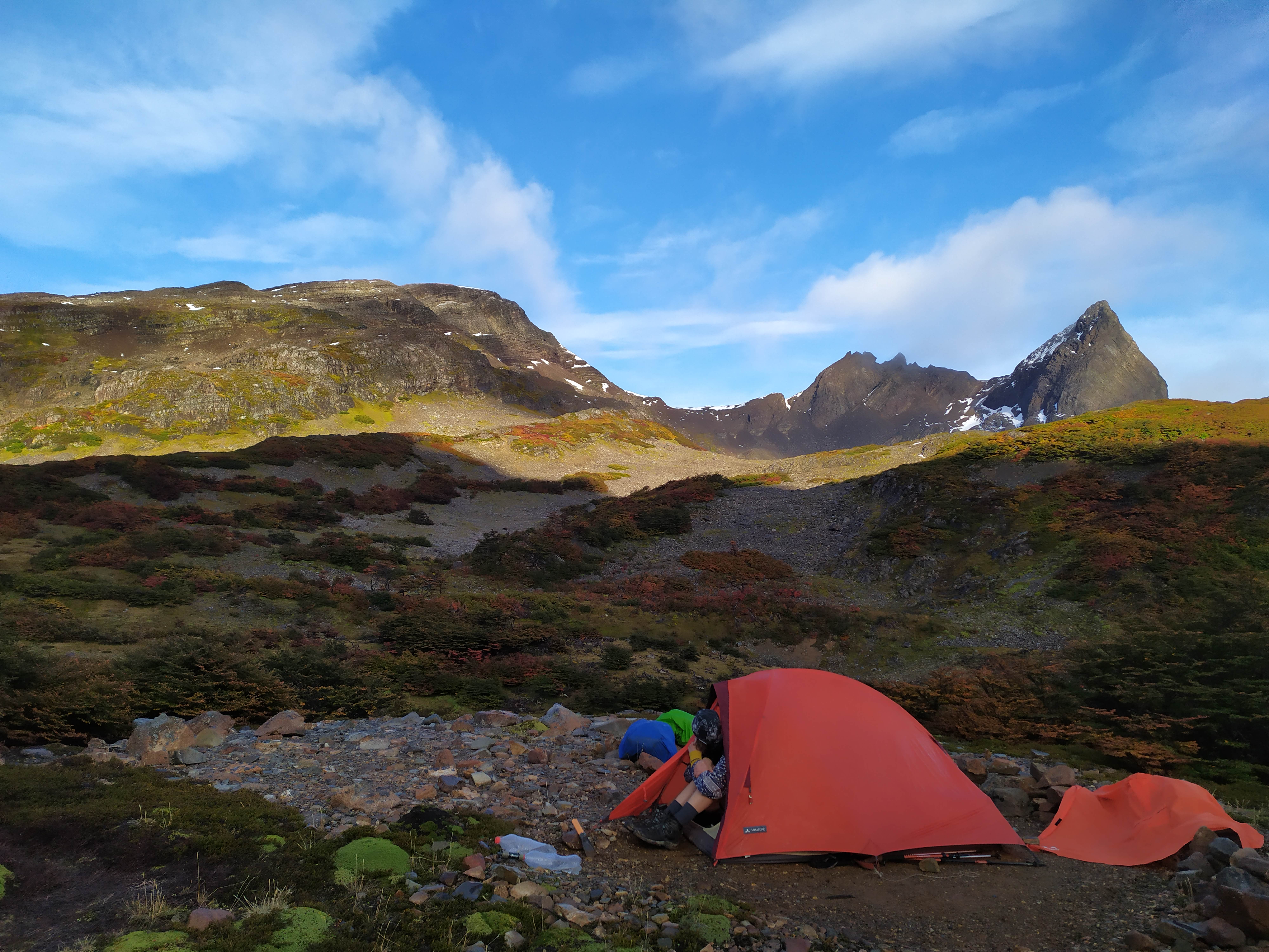
We’ll also remember Los Dientes as a big mud fest. The beautiful lakes are situated in natural wetlands and the herd of hikers that had passed this season left a muddy, hoofprintlike trail. A generous pourdown of Patagonian rain on our first day topped things off. In the better parts we manoeuvred from tree root to patch of grass, and in the worse parts Veronika got knee deep into the dirt. Unfazed, she kept walking in front pointing out for me the tracks to avoid 🙂 And figuring out the route. Though It started out nicely signed, the path gradually declined to a “choose your own adventure” wetland cross country.
So yeah, great fun all around on this last section of the GPT. Which, coincidentally, is also our last bit of hiking. We’re returning to Belgium April 1st. We will be happy to sleep in the same bed for more than three nights.
We’re grateful for having been able to make this trip. The fabulous routes we followed and the friendly people we met will be in our memories for a long time to come. We’ve taken a break from “real life” and tested some of our limits. We don’t quite know what we’ll do from here and we don’t know where we’ll end up, but I guess things will turn out great. That’s what happened on the trail as well 😉
Thanks for following along!
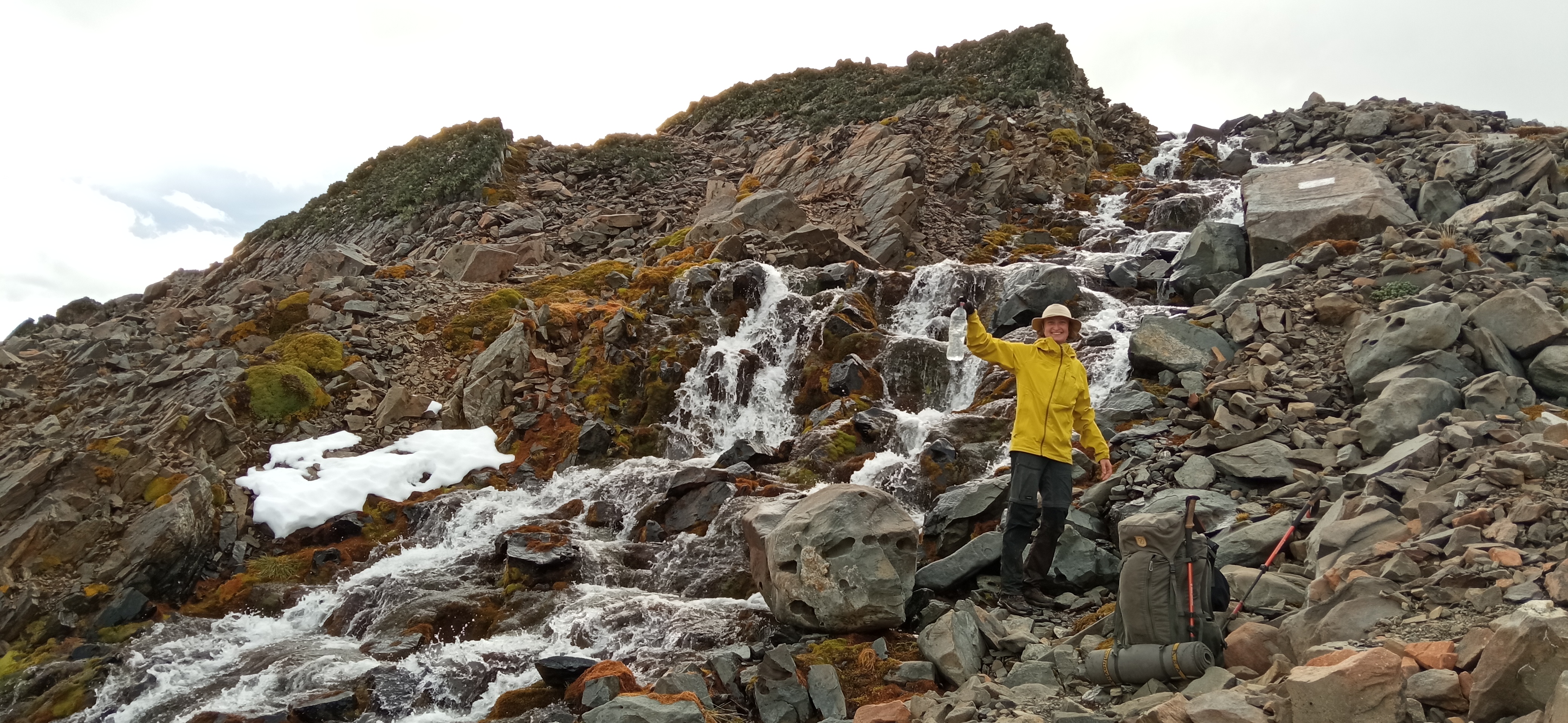
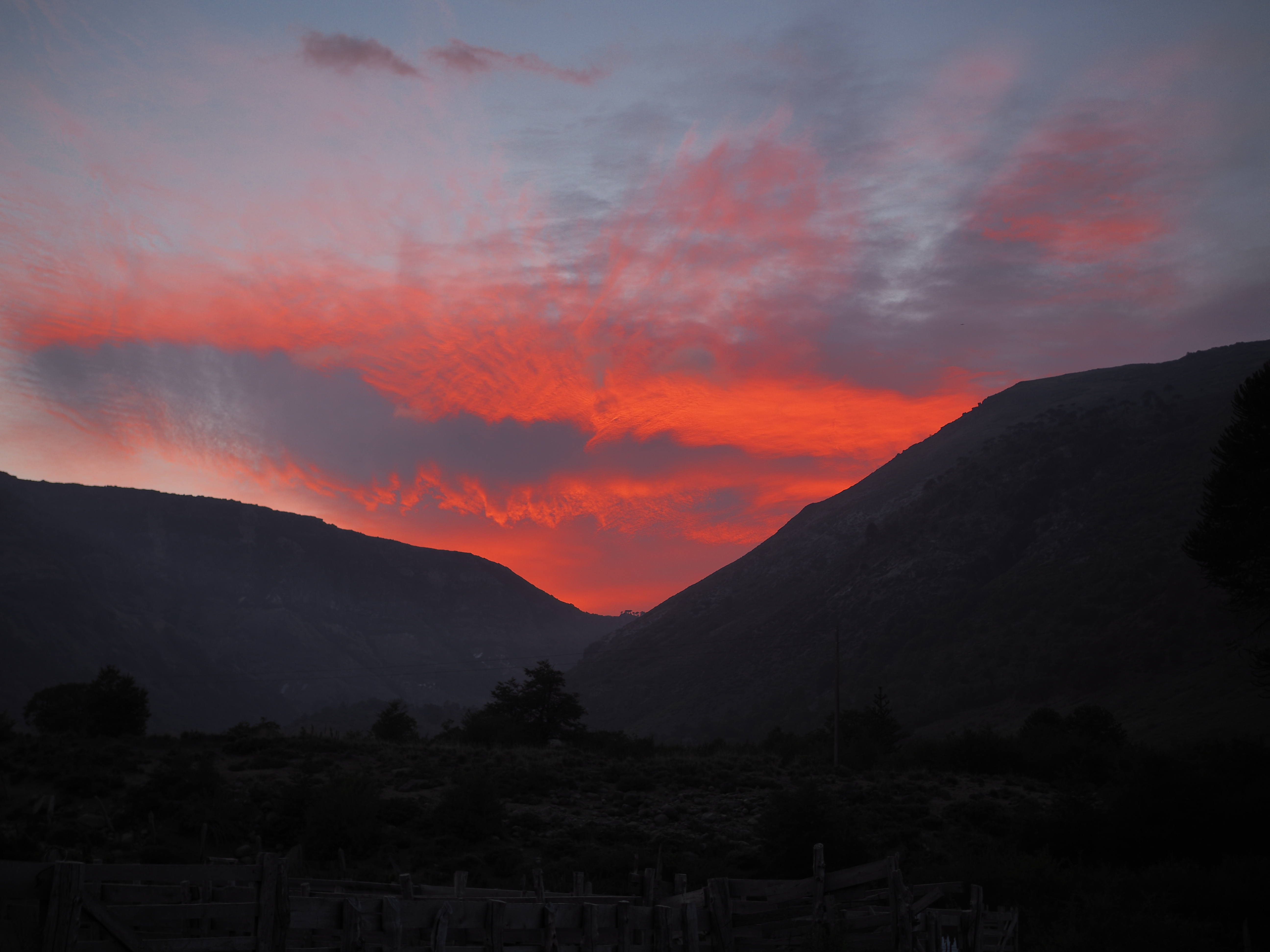
Getting to Navarino, the ferry passed along the fjords of the Beagle Channel.All in one picture: lakes, autumn colors, and the namesake Dientes.Veronika got an even better shot (but without lakes :p).The views never stop…… ever …… except in the mist :pFelt like a fairytale forest in the mist.Our tent in the morning. Too much mist and rain to take a picture the night before.Glaciar-fresh water.Getting back, the plane flew over the Southern Patagonian Ice Field, a remnant from the last ice age.
Though we have hiked more than 600 kilometers on what’s called the “Greater Patagonian Trail”, we didn’t travel in Patagonia yet. We stayed fairly north, where the weather is dry and stable in the summer months.
In Patagonia though, the weather gods are fickle and may swap pleasantly sunny for freezingly snowy in less than an hour. Strong winds chase the clouds across the plains and when a closeby mountain peak traps a dark one, you better have your coat and gloves stored at the top of your bacpack. As the saying goes, you can experience all four seasons in one Patagonian afternoon.
So yeah, who would want to miss that!?
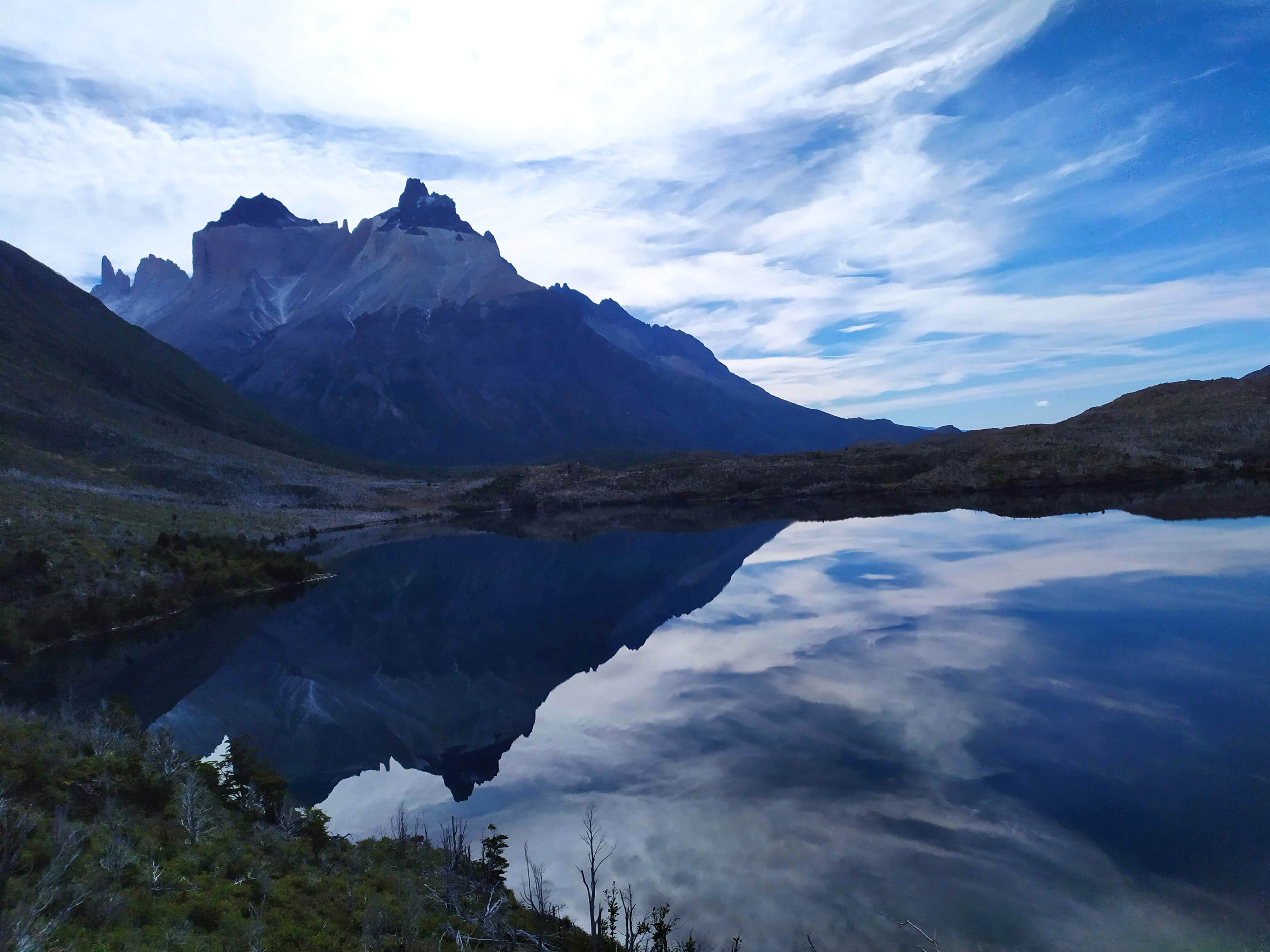
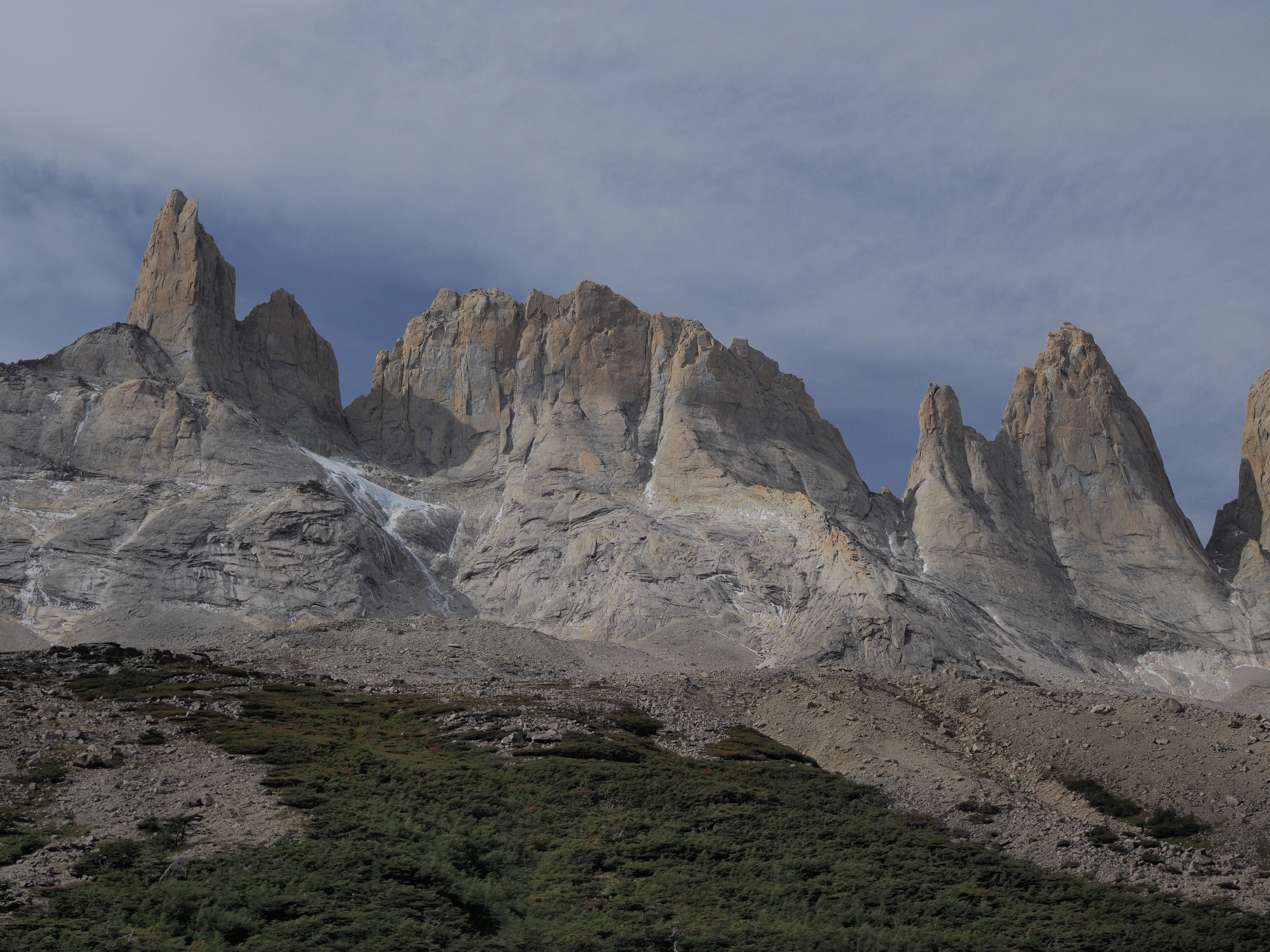
The consensus seems that no hike is more beautiful and quintessentially Patagonian than Torres del Paine. It’s got peaks, glaciers, rivers, lakes, windy passes, rainy nights, condors, pumas, forests, sunrises – all packed along a relatively easy trail. Every hill on the path is its own mirador, and when you’re thirsty, just grab some water from one of the many mountain glacier streams.
Due to this combination of natural beauty and accessibility, the hike (and its namesake natural park) has become extremely popular. Every day, bus loads of tourists are delivered to the entrance, which are expertly straight-jacketed into a caravan that shuffles from camp site to refugio.
Rule number one: no fire or smoking outside of designated areas in the camps. Rule number two: take your garbage with you. Rule number three: don’t ever leave the signed trails. Rule number four: no wild camping, which means that you have to book a stay in the commercial camp sites at pre-planned dates.
The rules make sense, and allow a larger amount of people to experience and appreciate nature at its most scenic. For instance, on this 130km trail, we found almost no human garbage, which was a nice change from the often messy arriero trails.
However, after roaming freely in the Andes for six weeks, these regulations took some getting used to. Similarly, the mass of people annoyed Veronika quite a bit. Getting stuck as the last wagon on a train of people inching its way forward on a steep small mountain path really got on her nerves.
The worst by far, however, was the shameless cash grab by the Fantastico Sur camp site company. For 24 euros per person per night, they provide a field to put your tent in, showers (often lukewarm or simply too few for the people staying the night), toilets, and a kitchen to safely use your own small cooking stove with the food you carried along yourselves. That’s it.
Except for the last one we stayed in. Upon checking in, we were informed that no cooking was allowed. No idea why. The fact that most of the food we had left needed to be cooked and we would go hungry without it was met with “we’re sorry.” Our remark that they could have warned us in the other camp sites (mostly run by the same company) so that we could prepare in advance, was agreed with, and nothing more.
Note that this particular camp site had a nice refugio for less thrifty hikers, a well-stocked bar and minimarket (at the same extremely inflated prices as everywhere else in the park), an industrial kitchen, plenty of dining space, a large terrace, and a spot for people to smoke. There was no reason to not allow people to cook, except to force them to pay for dinner and lunch on the spot. We made do with what we had, though :p (I don’t blame the poor shmuck behind the counter delivering the message to annoyed tourists, no hard feelings!)
We don’t mind paying a bit of “tourist tax” every now and then. But it needs to be clear up front and we’d like to decide ourselves if it is worth it or not. Note that the camp sites have to be booked before entering the park, and that there is no way to change these bookings once on the trail. The two companies managing them basically have a state-granted duopoly, which Fantastico Sur is way too eager to exploit…
This juxtaposition of Patagonia’s natural splendor with peak mass tourism was quite the experience. For me, the views were more than worth the annoyances, as Veronika’s pictures hopefully show!
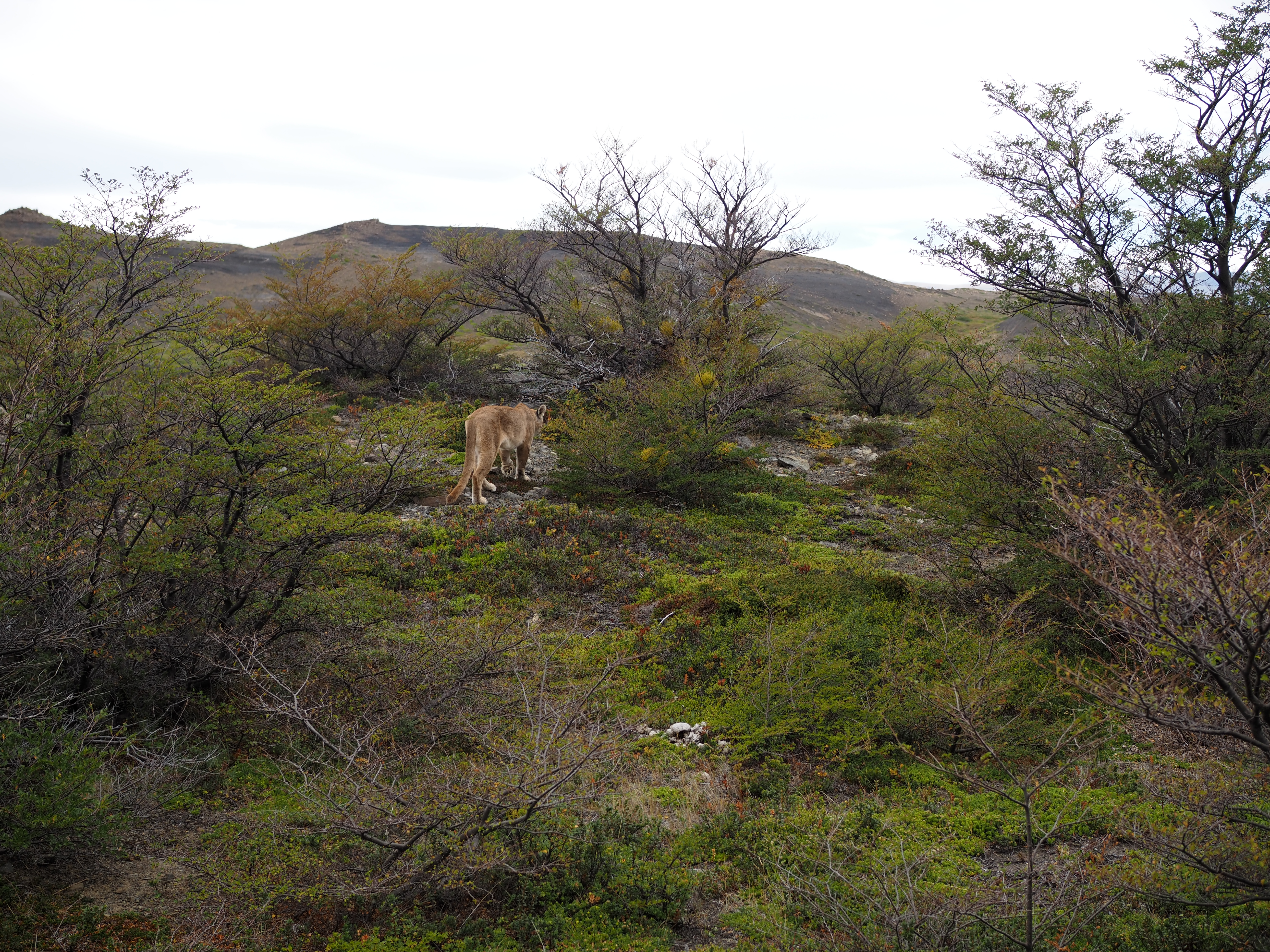
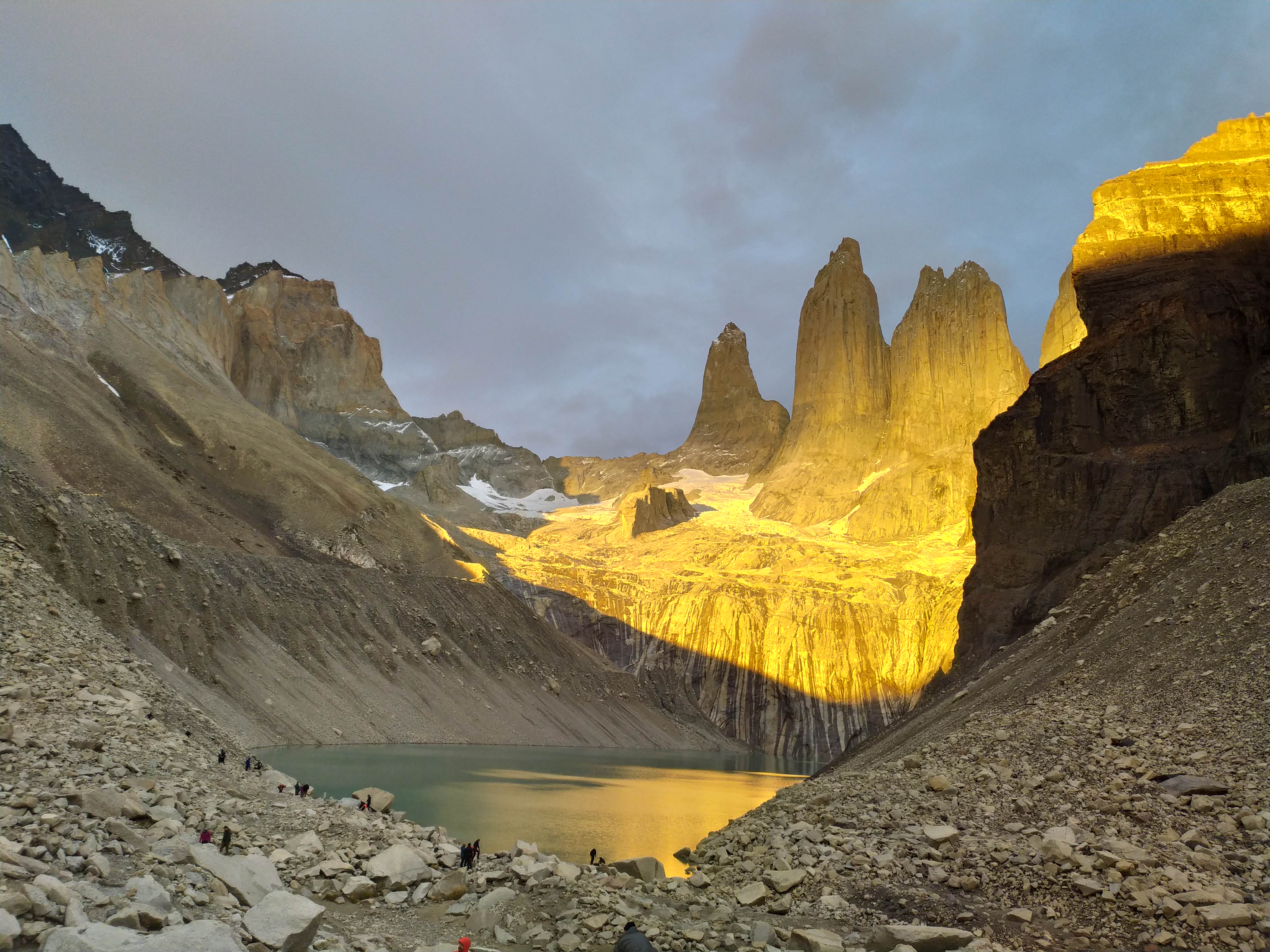
Even in the rain it’s pretty 🙂Glacier Grey from below the pass.Glacier Grey from belower the pass Glacier Grey’s offspring.Lago NordenskjöldMirador FrancésMirador BritánicoFelt really lucky to spot a puma!Sunrise at the Torres, as is tradition!Sunrise opposite the Torres.
At some point, things start to feel familiar. Climb up above the treeline, enjoy great 360 views after reaching a windy peak or pass. Descend to a verdant valley where the piñones drop on the ground around you when strong gusts of wind bend the araucarias’ branches. Arrieros come over for a pleasant chat, or simply wave from afar. And pitch your tent in a remote spot with some water and ideally some shade. We got to enjoy it all again on GPT12, the last part of our hike in this central region of Chile.
The main novelty was the weather. It was not awful, but just bad enough to soak our shoes and to force us to literally sweat it out under our rain jackets.
The weather gods started by conjuring up some menacing clouds on the other side of the valley. Next, a swelling wind started pushing them to our side. The gusts and gales got so powerful that suddenly, a thundering roar came down from the forested flank we were traversing. Panicking a little, I thought of a landslide and wanted to get away as soon as possible. However, as sudden as it started, the crackling noise died down. We did not leave anything to chance and quickly hiked away. Looking back over our shoulder, we could see a cloud of dust obscuring a giant araucaria, but instead of proudly pointing towards the heavens, it was leaning on some of its buddies. This was no landslide, as there was no rain yet, but it was a tree being unrooted by force of wind only! We were relieved to reach an open plain soon after.
Once the rain set in, Aeolus mollified a little. The backpacks got their rain cover, the humans their rain coats, and for half a day, we walked through light drizzle or plain rain. We were happy to find that an araucaria grove at our intended camp site was dense enough to block the rain in a spot just large enough to pitch our tent. Though rain and wind continued through the night and we were freezing by the time we got inside, all our stuff stayed dry, our bellies were full, and our sleeping bags were plenty warm.
In the morning, the wind and rain were gone and the Chilean sun was out in full force. Do the weather gods listen to cowardly prayers of fair-weather hikers like us?
A fallen comrade not far from its recently unrooted friend.Gathering clouds…Evaporation on sunny flanks the morning after.Veronika got lots of practice catching sunsets 🙂Camping spot in a +2000m pass.Some more cross-country, this time on a 60° slope.Araucarias lining the hills.The trained eye will immediately spot that these are inferior Argentinian mountains :pA nice puesto with all sorts of livestock.Veronika and puestero Segundo Romero holding up traffic :p
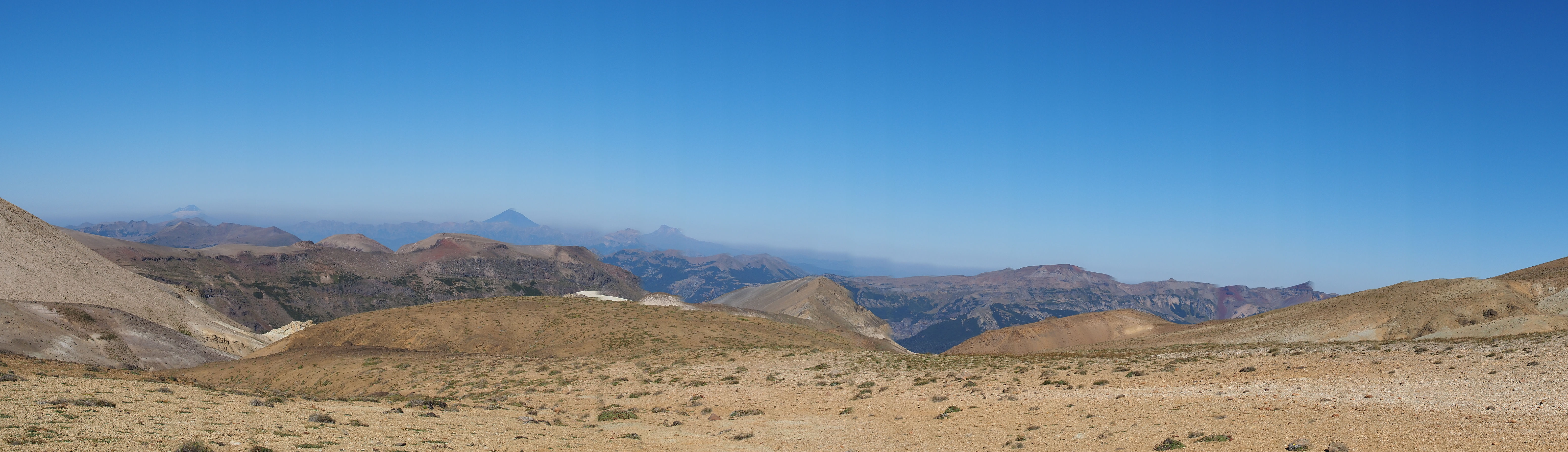
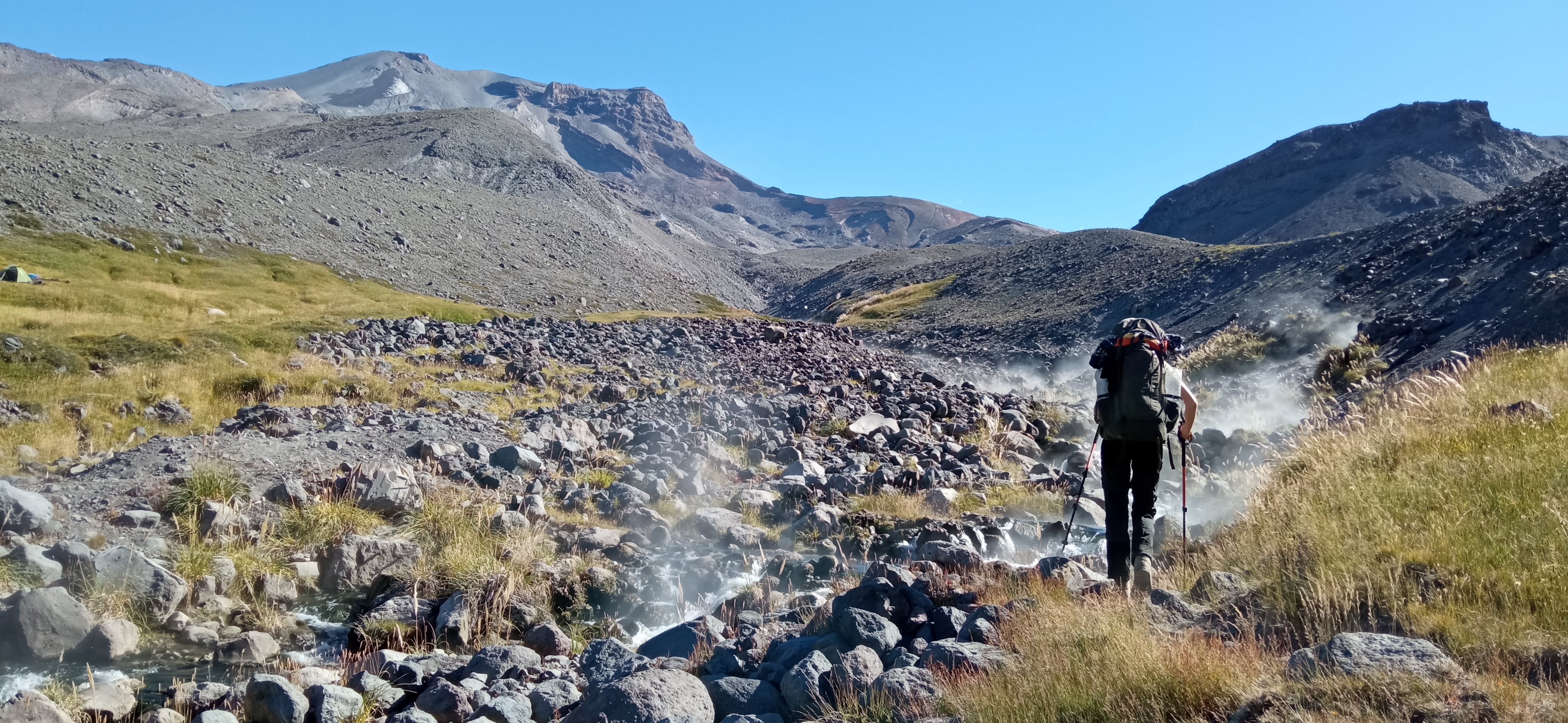
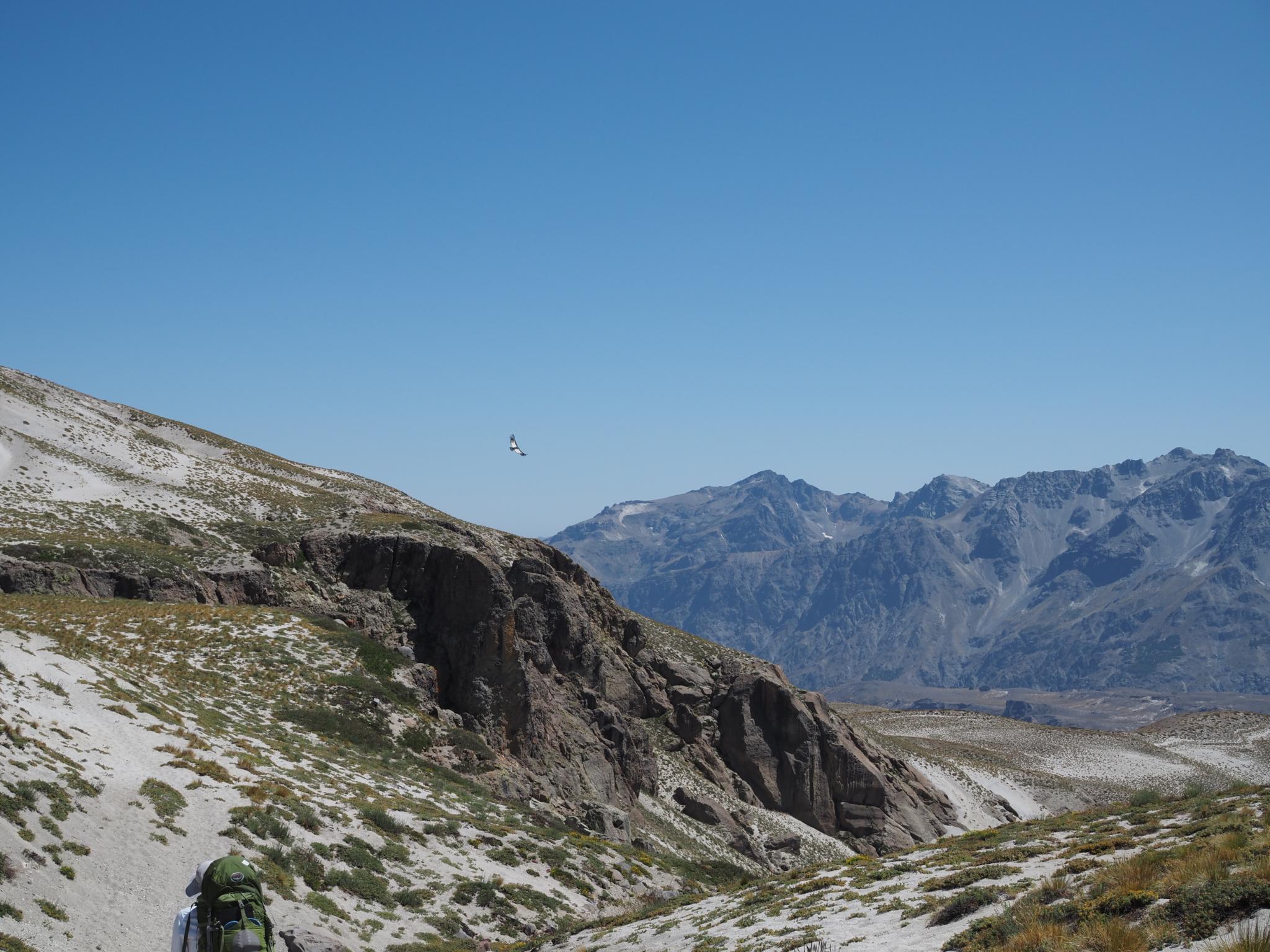
GPT11 is pretty short, and the route connecting GPT11 and GPT12 first drops about a thousand meters in altitude, to promptly go back up the same amount. You’re basically hiking from one +2000m pass to another, with a 1000m valley bottom in between. Instead, if the weather is fine, the GPT provides an alternative route that stays above 2000m on the mountain ridge. This alternative is “cross-country” – there is no clear path, but someone has managed to cross the terrain previously and provided approximate GPS points.
As the skies were crystal clear, and as we had enough supplies to postpone a resupply in the valley, we opted for the high altitude alternative. Staying on top of the mountains should also yield the most spectacular views, right?
Mountain ridges are not uniform. From the peak, several spurs of a mountain stretch out like loving arms to the valley below. Between these spurs, the mountain folds inwards like a pleated skirt, often with a (former) stream gulley cutting into the mountain side. This inward fold is called a re-entrant. The trick when hiking along a mountain slope is to never move to an incline that is too steep to find stable footing. This is often manageable on the spurs, but can be challenging when crossing the steeper re-entrants.
In our cross-country case, the incline of the mountain slope started out pretty steep on rather loose small rocks. By concentrating on keeping balance and avoiding the most slippery spots, we got to some more gentle spurs after about an hour. The mantra “someone has hiked this before, so it should be possible” turned out to be true so far.
However, at some point, we stared across a particularly steep re-entrant. Though we were hugging the suggested GPS points, we could not see how to get to the next spur – unfortunately this part of the cross-country route lacked even the suggestion of a possible path. Looking up to the peak and down over the spur, we discussed our options.
In theory, going up should lead to the connection of our spur to the next, as in the end, all spurs are connected at the peak. The problem here is that one can climb up steeper inclines than one can climb down. If the slope becomes too steep to climb up before the connection, we might not even be able to safely return on our steps.
Going down the spur seemed doable, but it was not clear whether we would ever be able to cross the re-entrant. We could not see the situation at the foot of the spur: it might end in a vertical cliff, both at the bottom side and at the side of the re-entrant. The only hopeful sign was a visible good spot to ascend on the next spur further down the re-entrant. If we could reach that, we were out of the woods (proverbially – we had passed the tree line long ago ;).
So we went down. Looking back, this was a mistake. Not in the sense that going up would have been better (though it might have been the intended route) but that the right decision was to go *back*. We knew the steps we had just taken were doable in both directions. Backtracking to just take the regular path through the valley would have cost us time and energy, but it would have been safe. And in the end, negotiating a dangerous situation also sapped all our physical and mental strength for the day.
But we scrambled down, looking for safe spots to put our feet. The bottom of the spur indeed ended in a cliff, but we were lucky that we could clamber down to the re-entrant before that, often sitting down on the rocks to lower our center of mass. The re-entrant was small and cramped, with a trickle of water turning the smooth rocks to slippery pitfalls. With the occasional slide down and our backpacks and trousers scratched by the sides of the gully, we finally reached the spot where indeed a steep path led up the next spur.
We would not make it to our intended camp site that day, but we no longer cared about that. When we finally had negotiated the cross country and got back on the regular path, we were happy to just have some bruises and scratches. And to have learned a crucial lesson on traversing mountain slopes.
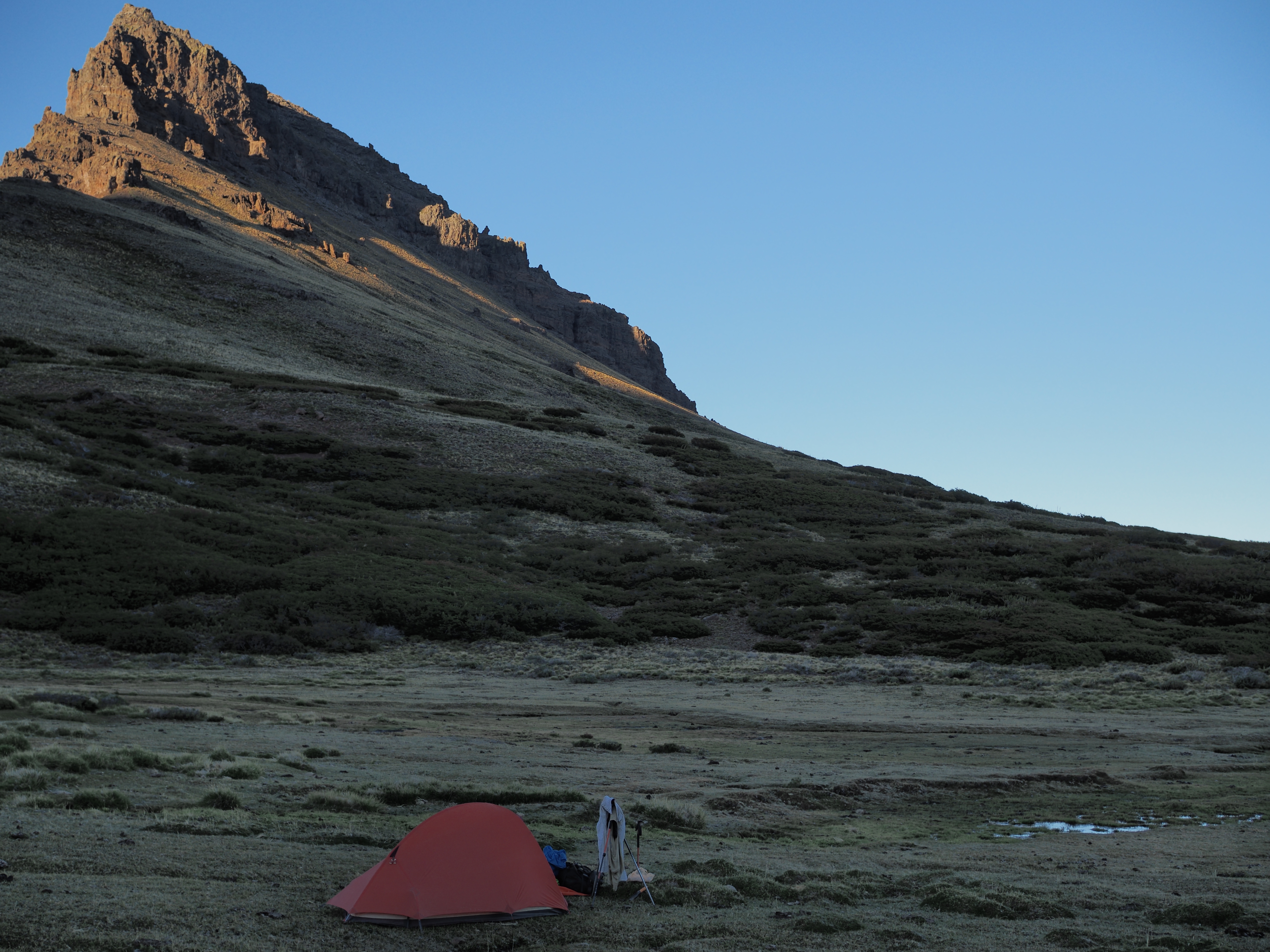
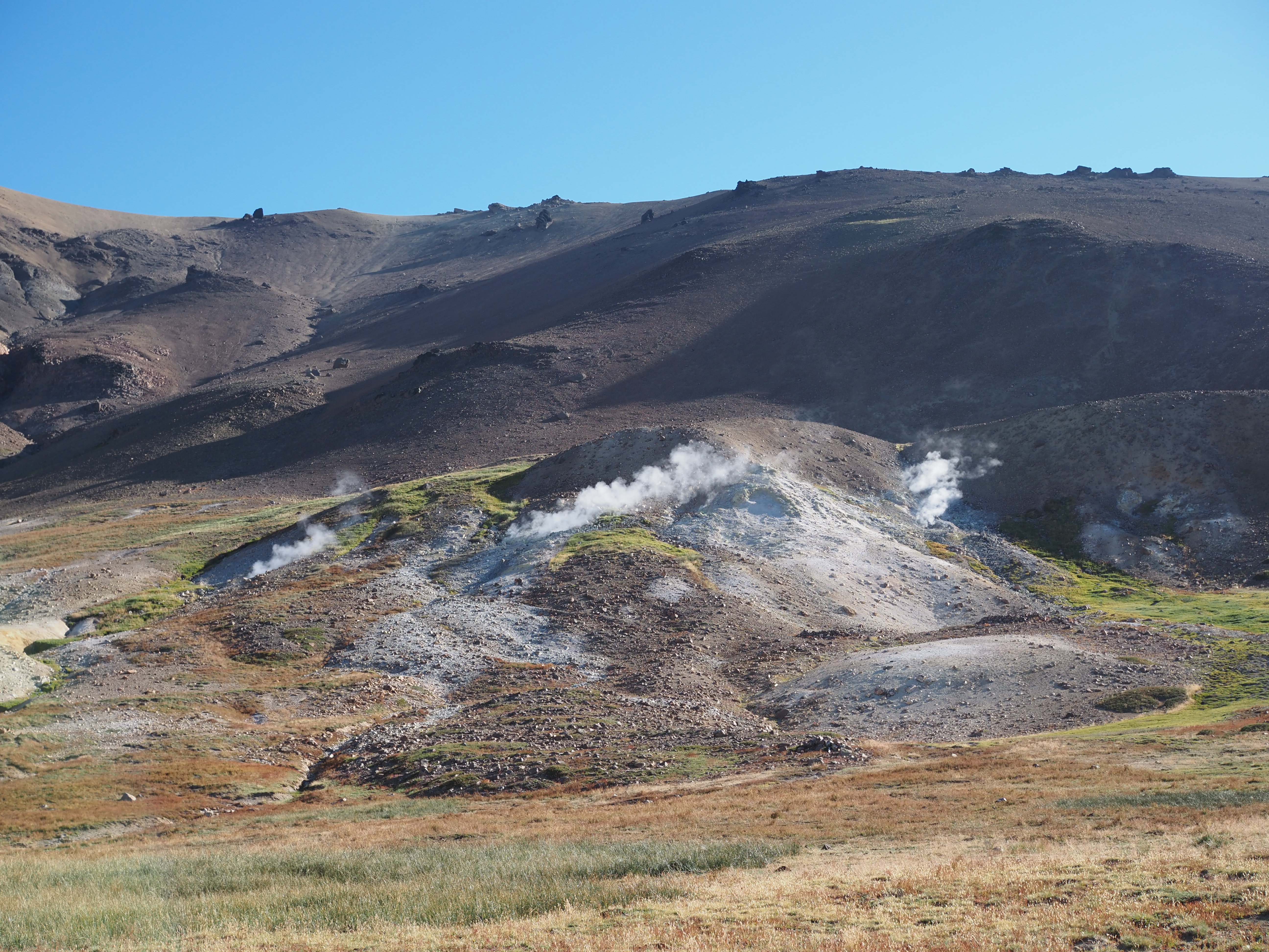
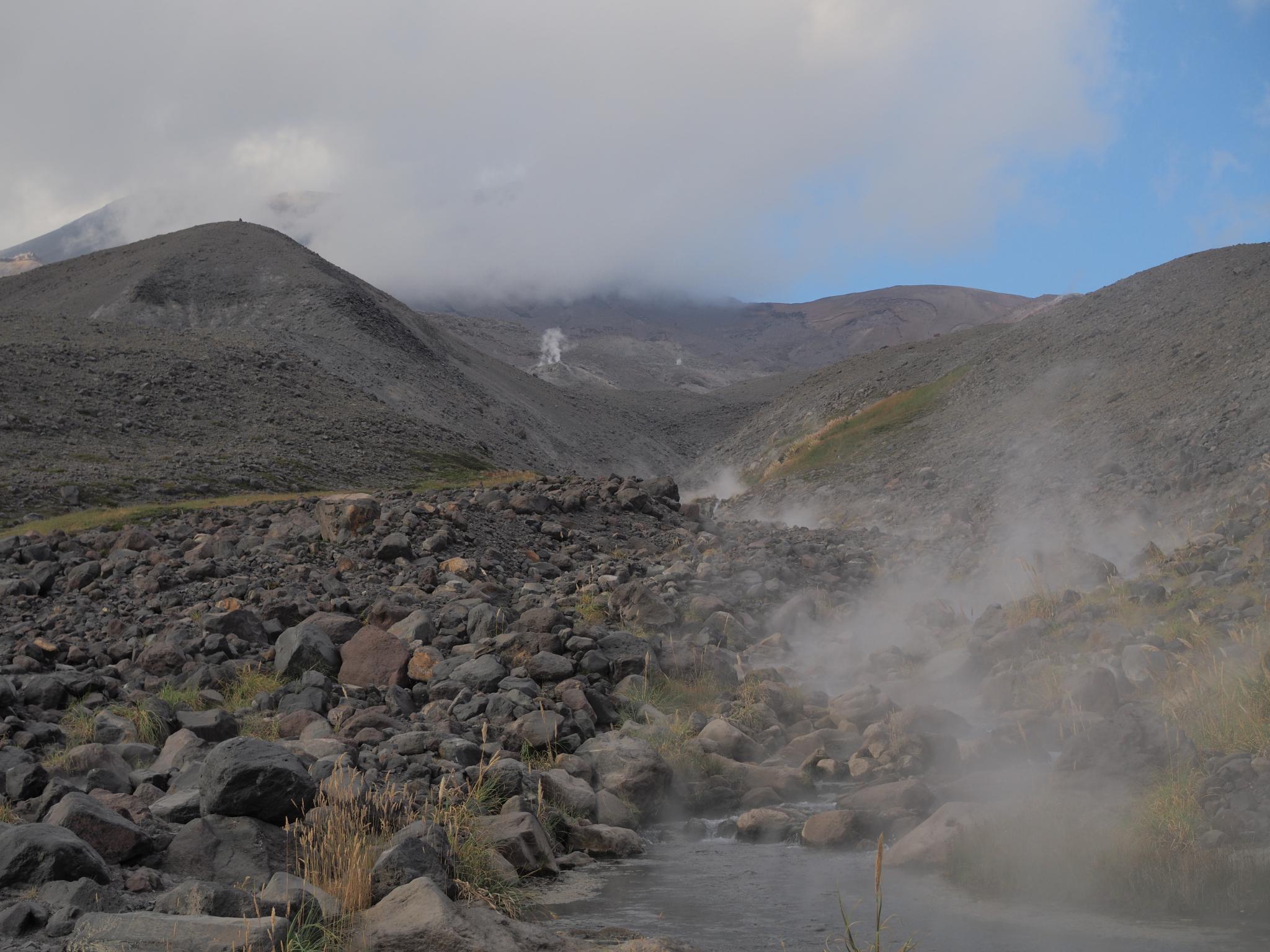
Diagon-ally?A bit of a path, but not for long.Not much of a scratch, luckily.A view to die for! :pOur camping spot at Termas de Pelehue after reaching the regular route late that day.More fumaroles!
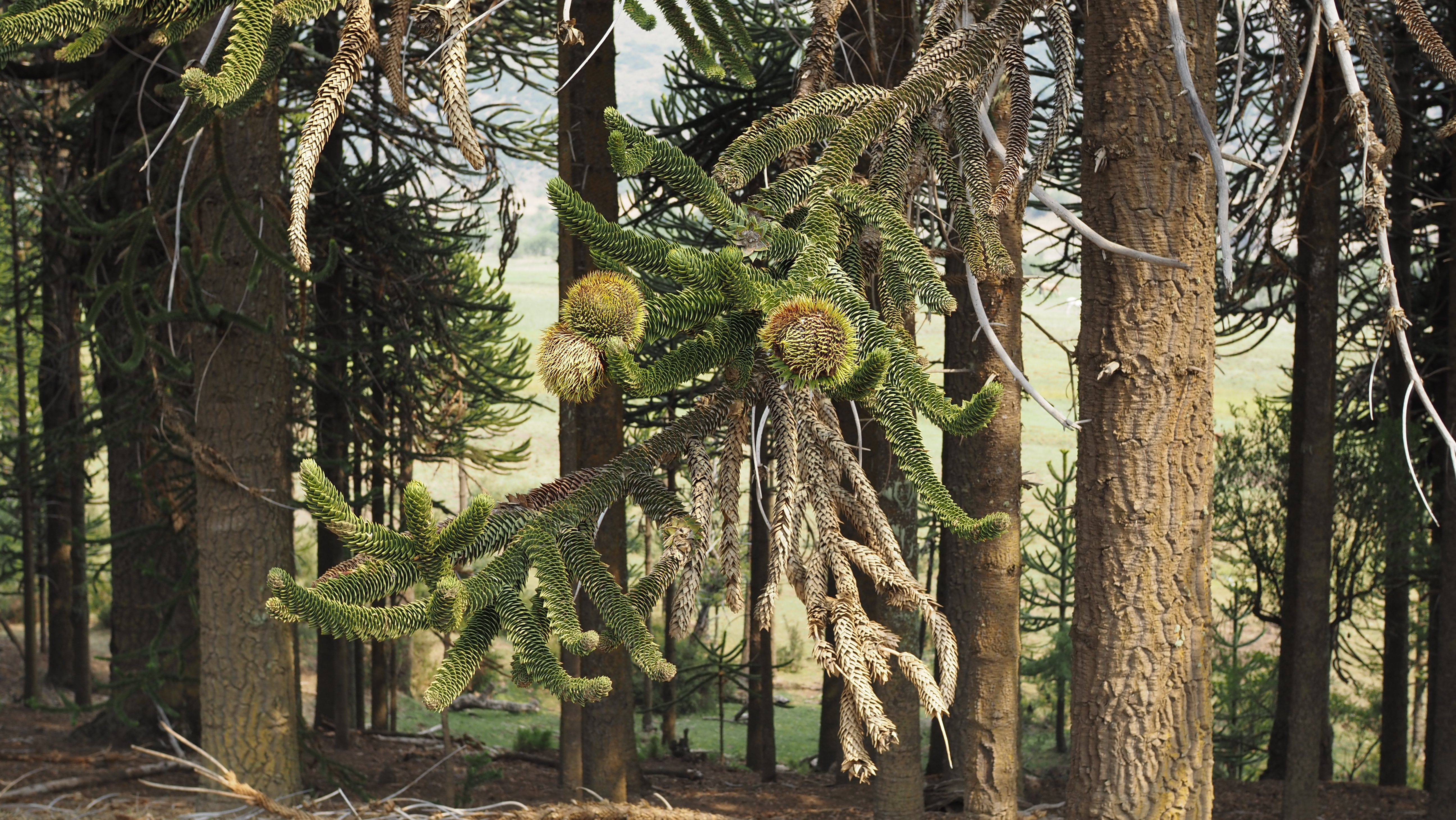
Blast, at the end of GPT08 I promised that GPT09 would feature Chile’s national tree: the Araucaria. While we did encounter our first Araucaria there, it was only in GPT10 that the tree became characteristic of the landscape.
In a nutshell, the Araucaria is a “living fossil”, unchanged since the mid-Jurassic. It resembles a pine tree with oversized pine cones and flattened, pointy, evergreen leaves that cover the full stem and branches. It grows straight and slowly, making its wood valued among carpenters. And most importantly, the thumb-long “piñones” (“pine nuts”) in its cones are edible.
That is, if you manage to harvest one of the cones. These typically hang high in tree, with the lowest still firmly out of reach. Following the instructions in the GPT manual, one has to “lasso” a cone with a strong rope, break it off, break it open, dissassemble into individual piñones, and cook them for half an hour, after which the individual piñon should peel easily.
In our experience, this works. More or less. With our “lasso”, we broke off part of the branch too (sincere apologies to our first tree!). And though cooking made the piñones tastier, it still took half a minute to peel one.
It was only later that we learned from the locals* the proper way to feast on this fruit. First, you wait for the cone to turn a “café” color (might take a couple of months, so plan your trip!). Then you hit it with a stick (a hiking pole will do). The piñones will fall to the ground as candy from a piñata. This is way easier than improvising a lasso, and most importantly, does not hurt the endangered Araucaria. The only thing left is to collect them, and either consume them raw, or cook them for two (2) hours and eat with honey after sliding off the peel.
By now, we’ve grown quite fond of the fruit. Raw, it tastes a bit like sweet chestnut. Cooked, the piñones have the starchy texture of potatoes, but with a lot more bite. And for hikers, the piñones have the advantage of being available high up on the mountain flanks. So you don’t need to carry them there in your backpack 🙂
* The Pehuenche are an indigenous people related to the Mapuche. For the Pehuenche the piñones of the Araucaria (“pehuen” in Mapudungún) historically were a staple food. I don’t know whether the people we met thought of themselves as Pehuenche, but they did live in Mapuche territory and they were eating piñones 😉
Our first succesful harvest attempt. Only some of the piñones contain an edible core. The rest are scattered on the ground.Caffé-colored cones.If you’re not fond of harvesting and cooking them yourself, you can sometimes buy them along the road in little green bags, still hot.
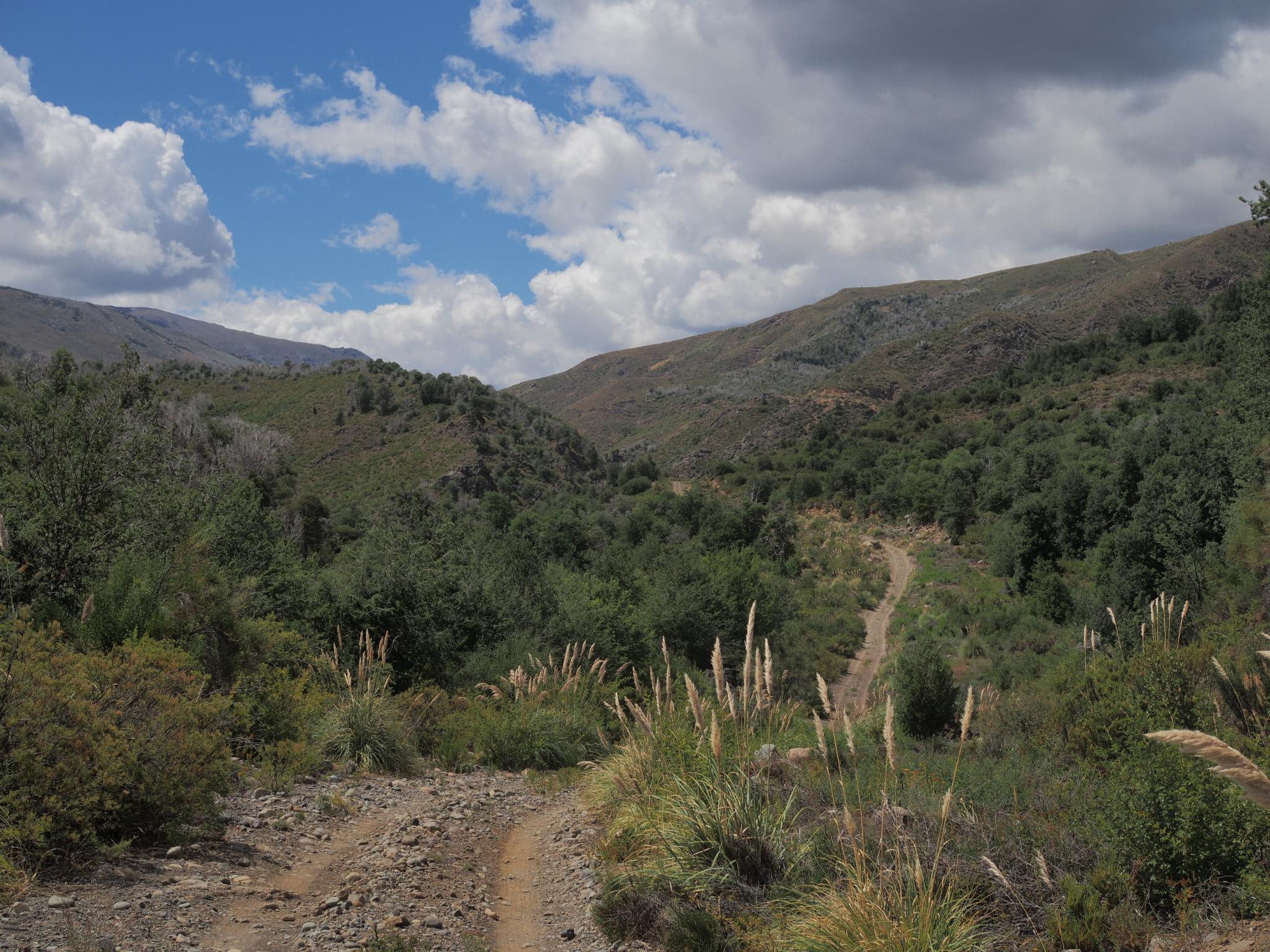
In general, the GPT tries to steer away from civilization and roads wider than a horse’s ass. This gives the impression of passing through uncharted lands to deliver landscapes not touched by humans.
This could not be further from the truth. The paths we travel have existed long before Jan Dudeck strung them together to create the GPT. They are typically well-maintained, as their principal purpose is to connect the livestock and the arrieros (and a bunch of other people, as it turns out) in these remote mountains with the rest of Chile. Though we happily use these trails, they are not made for tourists like us, and more often than not, we’re an attraction for the locals instead of the other way around.
Here’s a summary of who we saw during our two days on GPT09. Without exception, all were friendly and helpful.
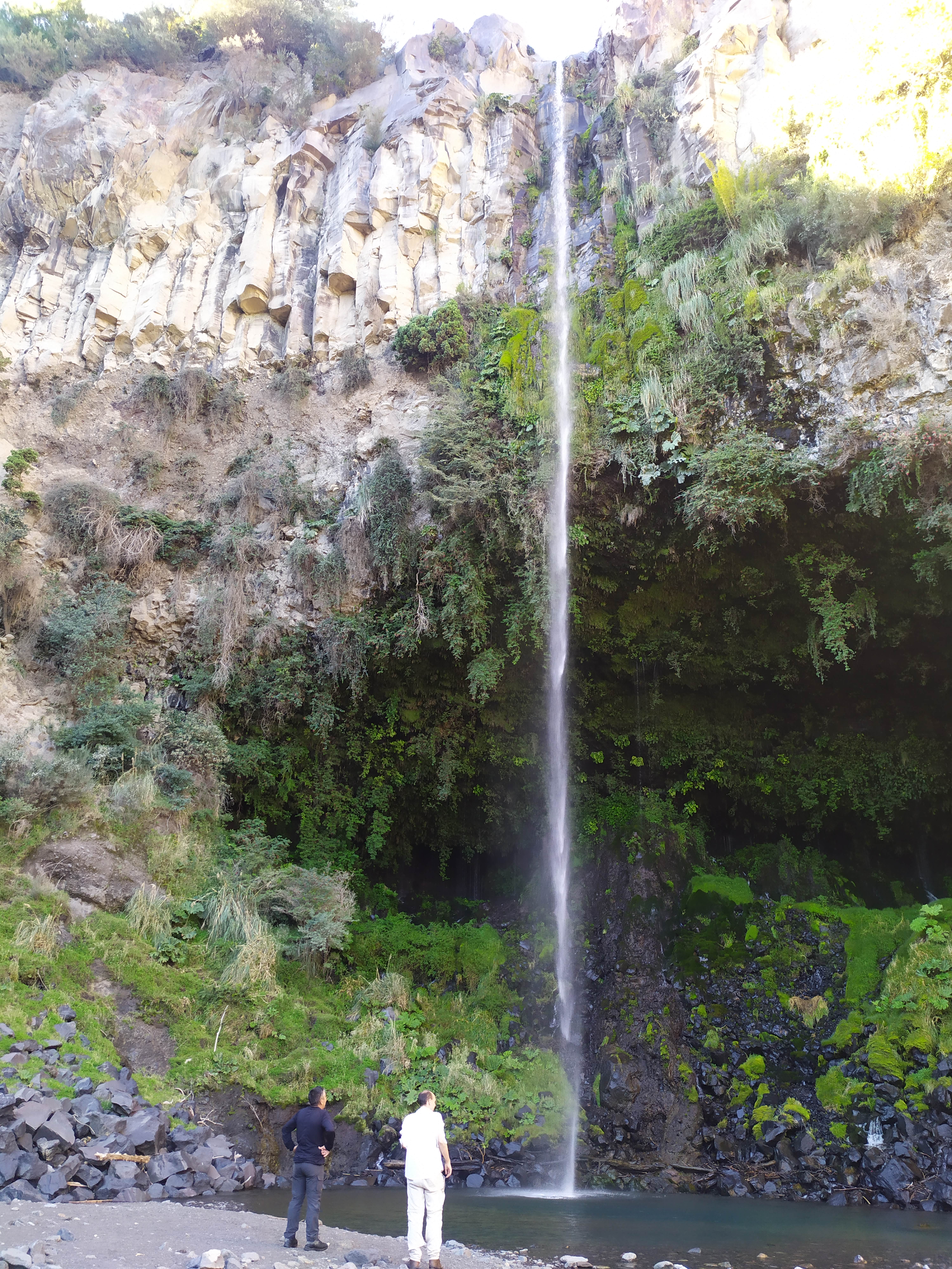
A salmon-fishing outdoorsman named Luiz who offered us a ride from Abanico to the national park when he saw us hiking on the side of the tarmac. He showed us a hidden waterfall and how to collect salmon bait insects from a stream.
A Chilean family having breakfast at the parking lot of the national park. They enthusiastically took pictures with us, and the grandfather remarked that Veronika had the same blue eyes as his daugther Stephanie.
A father and two sons returning from a quick hike in the national park. The father mentioned that the gletsjer of Sierra Velluda used to be much larger. Before climate change…
Two employees of the department of agriculture who wondered if we had seen any cows when traversing the national park. We did not, which they approved: the cattle should apparently be kept outside the volcanic plains of the park.
An arriero passed by when we were setting up our tent in the evening. Inquired whether we did not see a goat (we did not) and how long we did not see said goat (since 17:00). Told us we were welcome at the puesto of his brother a bit up north should the weather turn bad.
Two carabineros (national police) that happened upon our camp early in the morning. Must have been surprised, as our tent was sheltered from view (and from the wind) by a hill slope. Asked the usual questions on where we came from and where we went.
A boy, no older than 11, who was wandering on the path with his dog. We were hiking through a valley of puestos, so we assumed he belonged to one of the families living there. Asked if we could pass, which, fortunately, we could 🙂
An old couple, Juan & Salazar, living in the last, most remote puesto in the valley. They had a house in Trapa Trapa, the village in the next valley, where they lived in the winter.
Two boys on horseback, no older than 16. One was silent, the other was kind to explain that he was already doing arriero work, and would very much like to become one in the future.
A father and son with three horses, coming from Trapa Trapa going to their puesto on the other side.
Avelina.
Avelina is the mother of a Mapuche family living in Trapa Trapa, a small village at the endpoint of GPT09. At their farm, she provides food and lodging to weary travelers like us – even when they arrive at sundown covered in sweat and dust 😉
Avelina has a husband, a daughter and two suns. The husband and oldest sun (11) were out, working in the mountains, but they kept contact via a walkie talkie. Her daughter (9) had the name of a flower, her youngest sun (6) was called Mehuen – “fuerza” in Mapudungún. The water in her kitchen sink was constantly running from a hose connected to a nearby stream. Her stove consumed firewood, which her kids and us collected around the farm. A couple of lightbulbs provided light, except during an unexpected but not uncommon electricity outage when we switched to a candle.
Avelina was a kind and pleasant host, teaching us how to “drink” harina tostada late in the evening and preparing tasty sopaipillas in the morning. We talked about a lot – Chile, Belgium, Mapuche language and culture, and a whole host of topics I’m forgetting. It was a memorable and fitting end to GPT09.
Luiz quickly showing us a hidden waterfall close to the road.Apparently, “colorado” means “red”.The gletsjer on Sierra Velluda used to be much larger and lower.The arriero resuming the search for his goat.Our first Araucaria tree!The secluded spot for our tent.The puesto of Juan & Salazar.
When we mentioned that the highest mountain in Belgium is about 700 metres tall, we were sharing a perfect temperature hot spring with three adventorous Chileans. They smiled, and I could see them think “No wonder these tourists like our mountains a lot.” And maybe it’s true – the historic center of Bruges was not very magical to me either when biking through it to get to school.
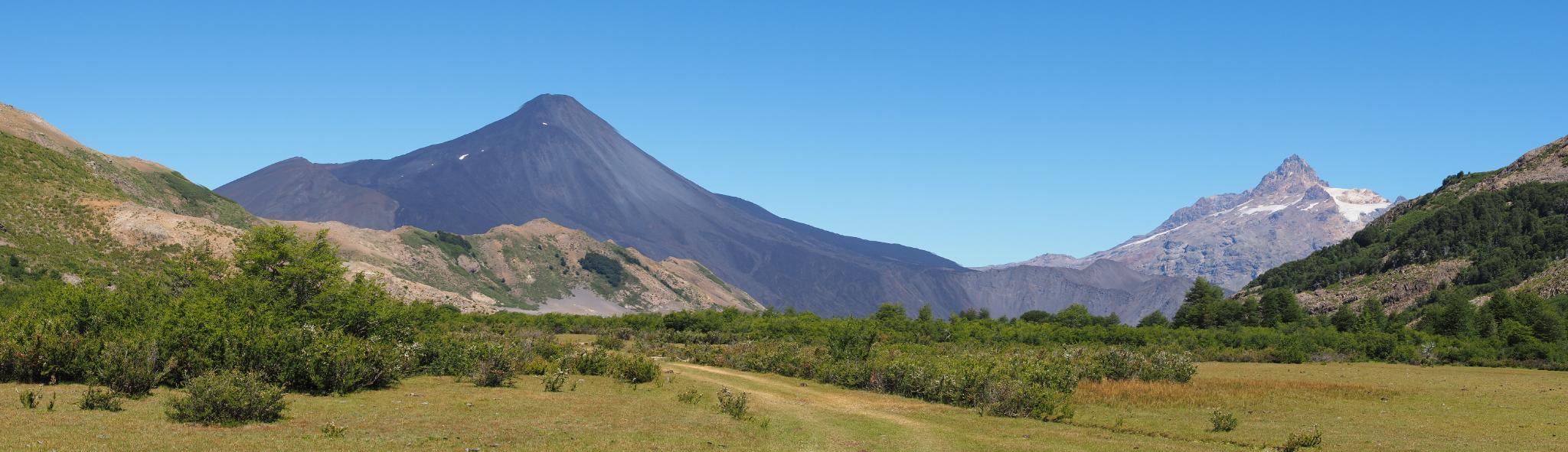
So yeah, once again we got to enjoy some of Chile’s more remote natural features. Volcán Chillan released an impressive smoke cloud every couple of hours, while the rivers at its slopes steamed day and night. The mountains flanking Laguna Laja provided stunning sights, not only on the blue laguna below, but on the polished Volcán Antuco next to the glacier-adorned Sierra Velluda in the south as well.
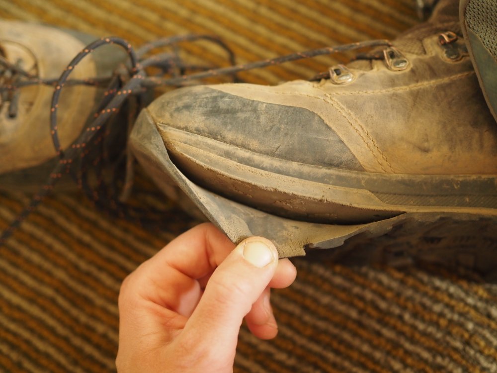
But of course, it’s not all rose scent and moonshine*. Veronika’s shoes started to disintegrate, so we escaped to Concepción to buy new boots. Apart from the delay, this also means sore feet for a couple of days, as a happy marriage between foot and boot requires the painful development of (literal) thick skin. I’ve got some bruises from falling down on loose scree slopes. And of course, the psychological damage from spending every waking hour together is becoming apparent. Or not. It’s hard to tell.
The weather remains great, with only a couple of rain clouds that in the end got stuck on the mountain peaks. And we’ve gained our “hiking legs”, managing more than 20 km on most days.
Anyway, next up is passing Volcán Antuco and Laguna El Barco. I’m looking forward to see the araucaria trees after which the Araucania province is named.
*This Dutch expression is clearly better than “it’s not all roses”.
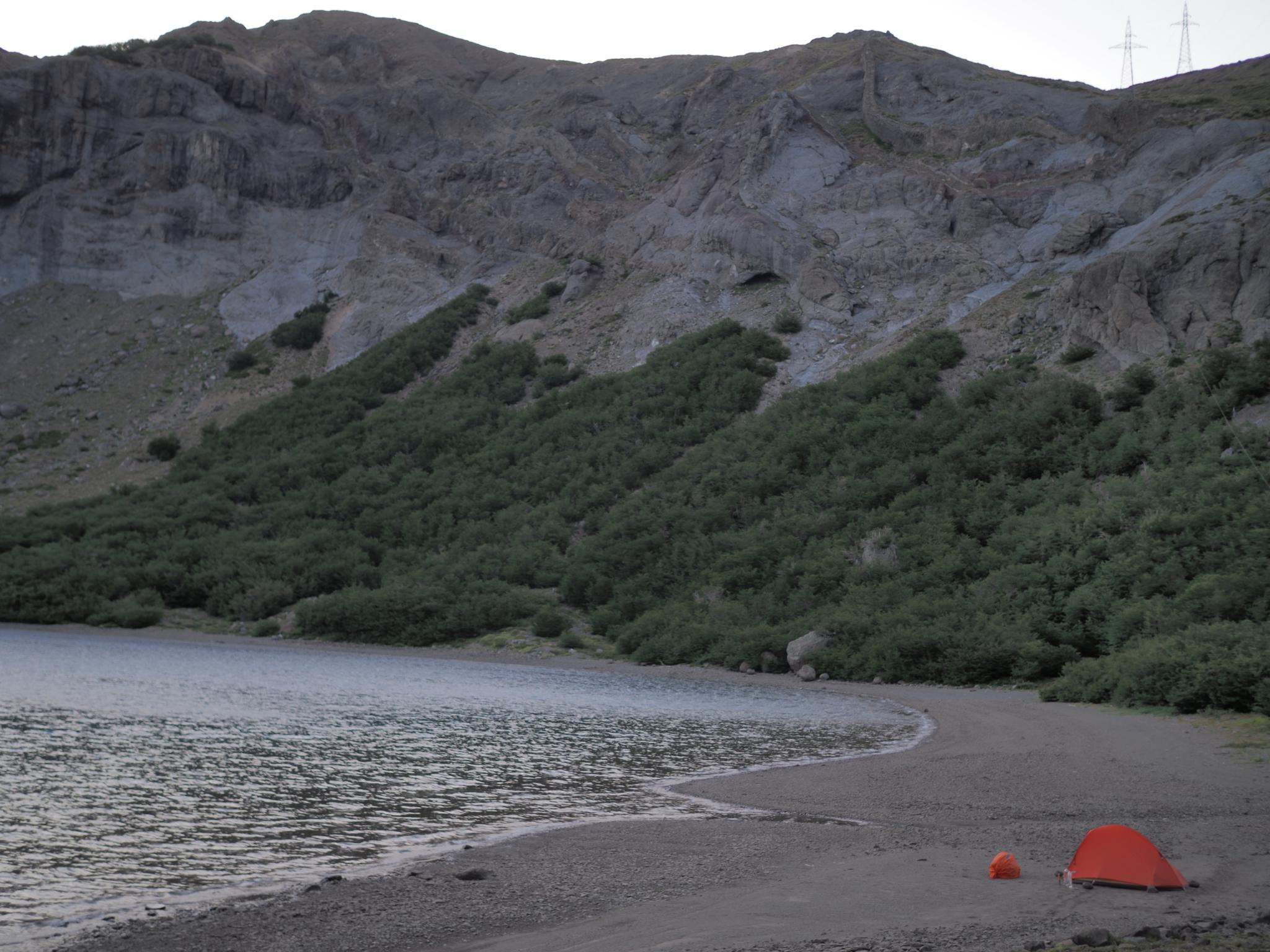
Laguna Hermosa after sundownVolcán Antuco and Sierra VelludaTop to bottom: Laguna Laja, Laguna HermosaStill life “Man aan de haard”Hot rivers around Volcán ChillanLeft to right: Laguna Laja, Volcán Antuco, Sierra VelludaVolcán Chillan in action
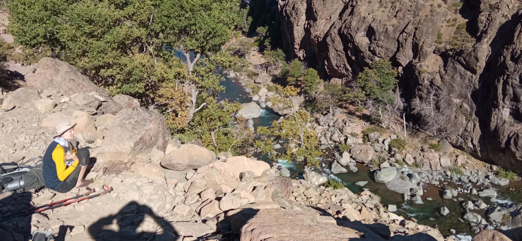
Even though the rain gods are firmly on holiday (somewhere in Europe I’m afraid) I think ‘water’ is still an appropriate summary for GPT08, simply because there was so much of it! Most of the time, we followed river valleys, with the occasional rapids and cascades. Higher up, the landscape transformed into a high-altitude meadow, inundated by either natural wells or by human-made canals. This kept the green grass growing for the livestock, but it also created swamp-like hiking conditions sucking in our boots 😀 We got to refresh in hot springs twice, the second time in two idyllic little bath tubs with perfect water temperature. Next was the sapphire Laguna del Dial, sufficiently warm to swim (for one of us at least ;). And the last days, in the gorge of the Río Gonzalez, our feet got plenty wet during a handful of fords (some acrobatic rock-skipping kept our them dry during another handful of crossings).
With lots of water, there’s lots of life. Cows, goats, dogs, horses, water fowl and tiny sparrows. And of course, humans. On horses. Chasing lost knifes or lost friends. These are the Arrieros: Chile’s cowboys tending their livestock in the verdant pastures high in the mountains during the summer. They live in small puestos, ranging from ramshackle collections of rope, pole and tarp, to proper aluminum cottages with accompanying stables. Most of the time, the few trees in the meadows predict a puesto’s location from afar.
The Arrieros celebrate San Sebastian on the twentieth of January. We found this out when the GPT manual mentioned that a señora Irma sold home-grown food at her puesto. At our approach, we were greeted by a dozen tied-up horses, some cars, a couple of tents, and the sounds of a guitar being played. In the shade of the trees, nicely-dressed people chatted and drank along a long wooden table. The atmosphere felt like a large family party, though after inquiring, friends and acquaintances were present as well. We felt a bit out of place, but fresh goat cheese and tomatoes would be a welcome break to the monotony of couscous, dried mushrooms, instant soup and nut mixes – our typical hiker grub. So we petitioned in our politest Spanish (which probably still is childishly rude 😉 and Irma was happy to oblige. While waiting for the food at the back of the fiesta, a voice and drum began accompanying the guitar. Shortly after, an Arriero and Arriera started dancing the cueca – a complicated dance full of history. Though the people were most friendly and welcoming, we did not stay long. It was their holiday, and we had miles to go before we slept.
Finishing this section was rather tough. Thirty-five kilometers before the end, Veronika’s stomach decided that up is the new down and switched careers to fountain, much to its owner’s dismay. The last day, Veronika basically survived on a little breakfast porridge and a hundred gram of couscous. This was way too little to properly hike, but luckily, the trail was mostly downward, I could manage most of our backpack weight, and Veronika soldiered on. We were really happy to reach El Inglés to take the bus to San Fabián to recover for a couple of days.
The next section along Volcán Chillan looks daunting. Lots of altitude gain and loss. And active volcanic territory 😀
Veronika ready to ford. Reminds me of a film about someone who lost some piece of jewelry 😉Laguna del DialIf you zoom in, you can see some Arrieros guiding their horses down the valley.The dark spot next to Veronika used to be her breakfast. She’ll have to bring her A game to puke in a more scenic spot next time :pA more remote puesto.Señora Irma’s puesto during the long weekend of San Sebastian.A Chilean Arriero as we experienced them. Picture courtesy of https://www.flickr.com/photos/leoncalquin, as we did not have the courage to ask permission to fotograph them from a short distance.
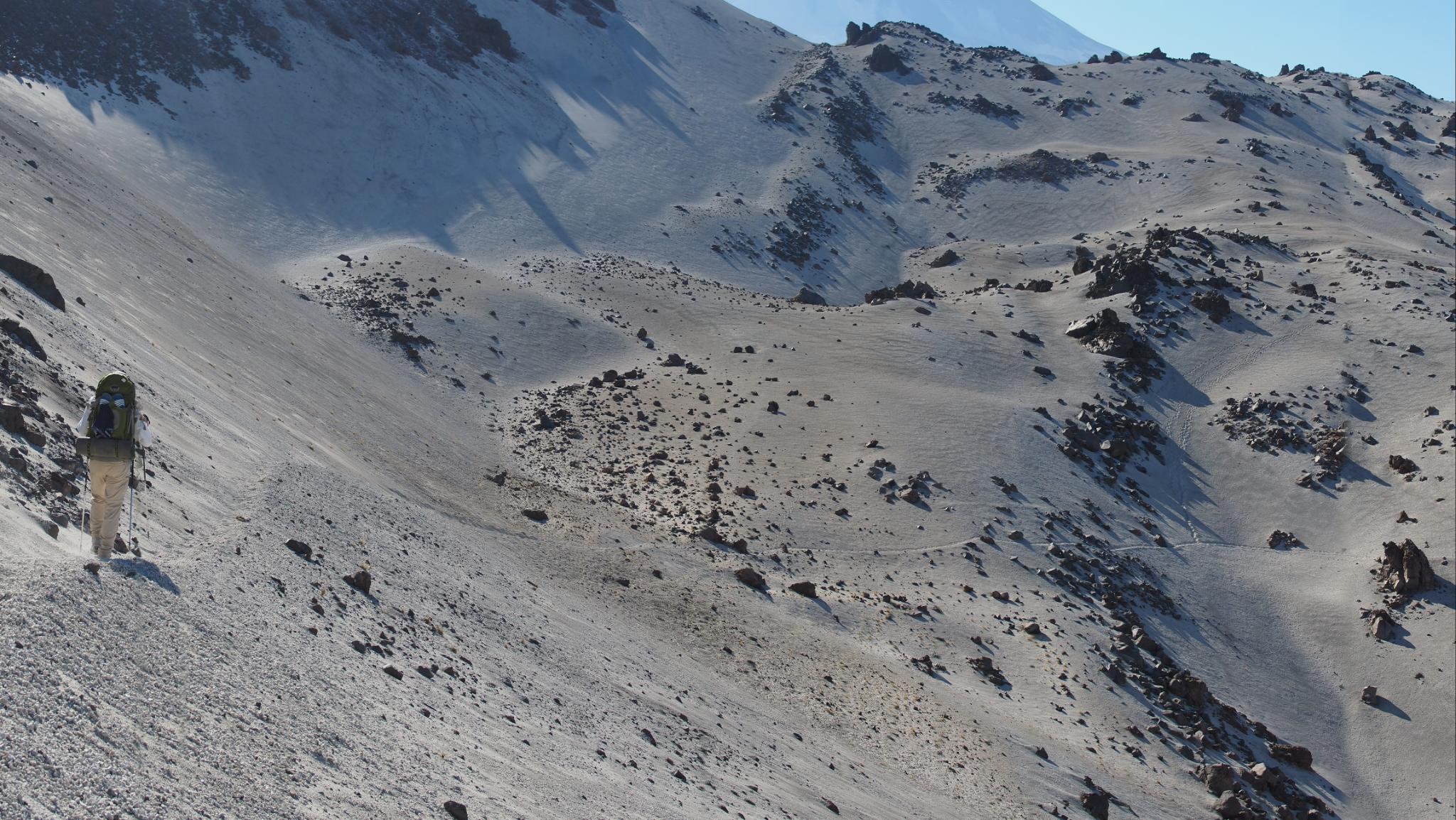
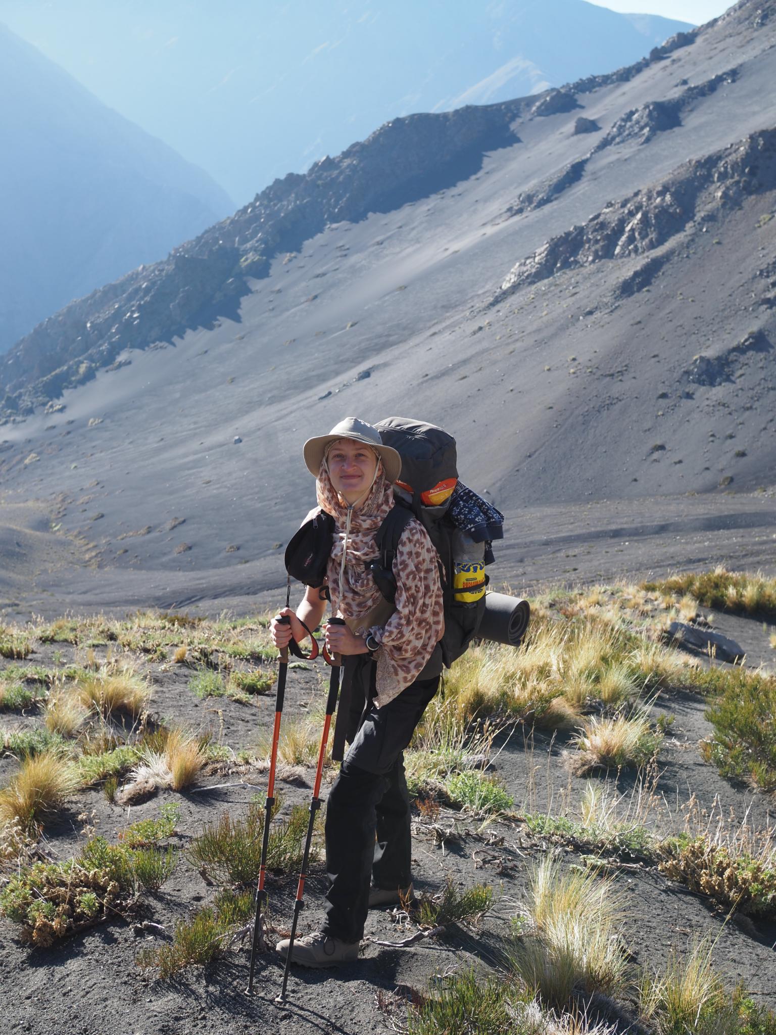
We’re beginning to understand how the Tuareg people travel through the Saharan desert. The trick seems to be to fully cover the body with loose-fitting clothing, so that in the absence of any shade, you basically make your own.
At least, that’s what seemed to work for us when hiking through the volcanic sand dunes and rocky wastelands surrounding El Grande Descabezado (the great headless one). We tried building a makeshift shelter from a spread open poncho, walking sticks and a couple of large rocks, but strong gusts of wind eventually tore it down. Using the tent to blot out the mid day sun suffered from blocking the wind as well, which yielded an excellent greenhouse, but not quite what we aimed for.
So yeah, you can picture us as two shuffling silhouettes on the side of a sandy slope, backs bent under the weight of our packs, only our hands and face uncovered by fabric.
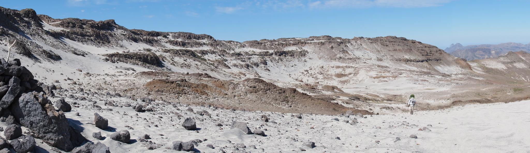
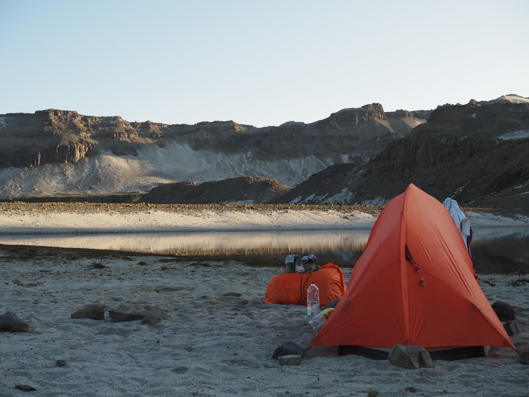
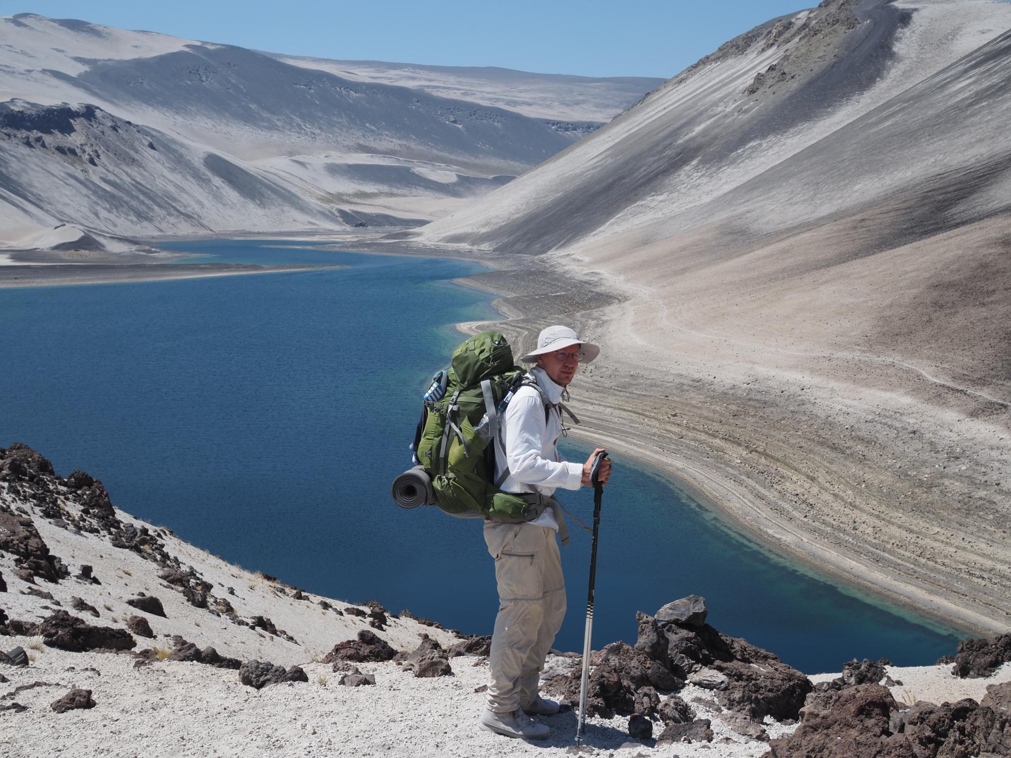
That picture would not be the whole story though 😉 We did suffer the heat of the Andean sun, and we did struggle with volcanic sand making every step only half as effective. But we also got to enjoy breathtaking views of moon-like landscapes, to get notified of a condor soaring overhead through its shadow passing by our feet, to swim in clear (and not so clear) high-altitude lagunas, and to smell the sulfur odor of hydrothermal vents (with the occasional lukewarm pool). There were a surprising amount of rivers just sprouting out from the ground as well as lingering snow protected by a top layer of sand, so we never went thirsty for long. And we simply took it slowly in our first six days, averaging about 13 km a day.
After that, we were out of supplies. And with the weather turning bad on Sunday, we recovered during the weekend in Talca, a big city with supermarkets and people. Which is about the opposite of the hike so far – we met other people only at one camp site, and being tired, hungry and late, we did not socialize.
Monday afternoon, a microbus will take us to Termas El Médano, the start of GPT07. More plants, more cows, and more people live there. We’re curious!
It took each of us a double covid test, triple vaccinations, and a handful of affidavits to simply be allowed entry to Chile. After that, the regulations require a ten day online self-report on whether you show any from a very broad list of symptoms. As the trail we plan to hike only has sporadic cell phone coverage, we could either ignore the self-report in those cases (probably without consequences) or delay the thing and stay put for a while.
As we still had some sleep to catch up and plenty of preparations to make, we opted for the latter. We took the opportunity to also dutifully fulfill our role as tourist: Museo de la Memoria, Museo de Arte Precolombiana, the winding alleys of Valparaíso. Leaving out the details: Santiago is hot and crowded, Valparaíso is cool, colorful and much preferred.
Right now, we’re in Curicó, capital of the eponymous province, whose name is derived from the Mapuche for “land of black waters”. Crucially, Curicó is close to our starting point on the Greater Patagonian Trail, as tomorrow, January 10th, the Chilean government finally deems us covid-free.